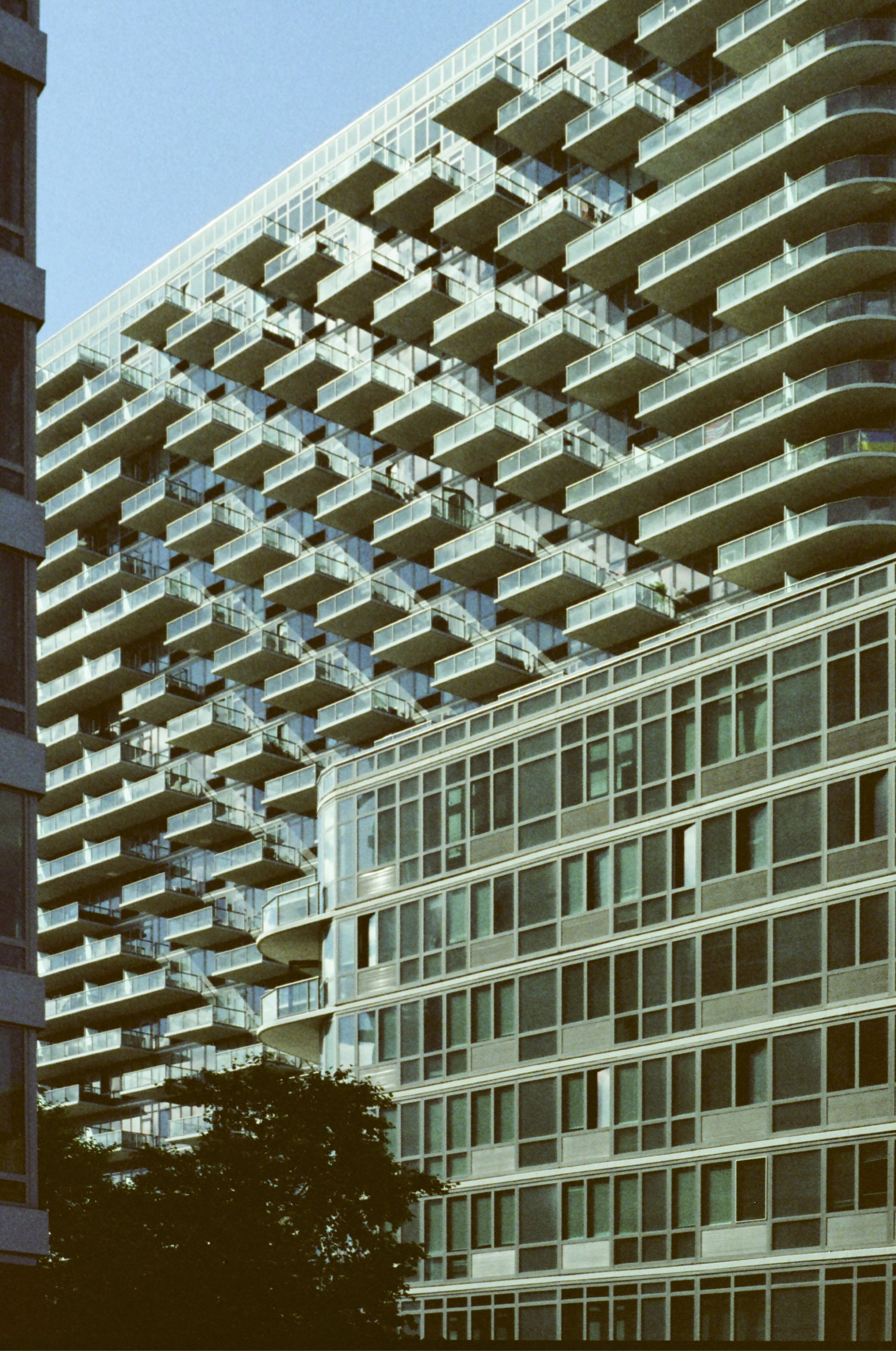
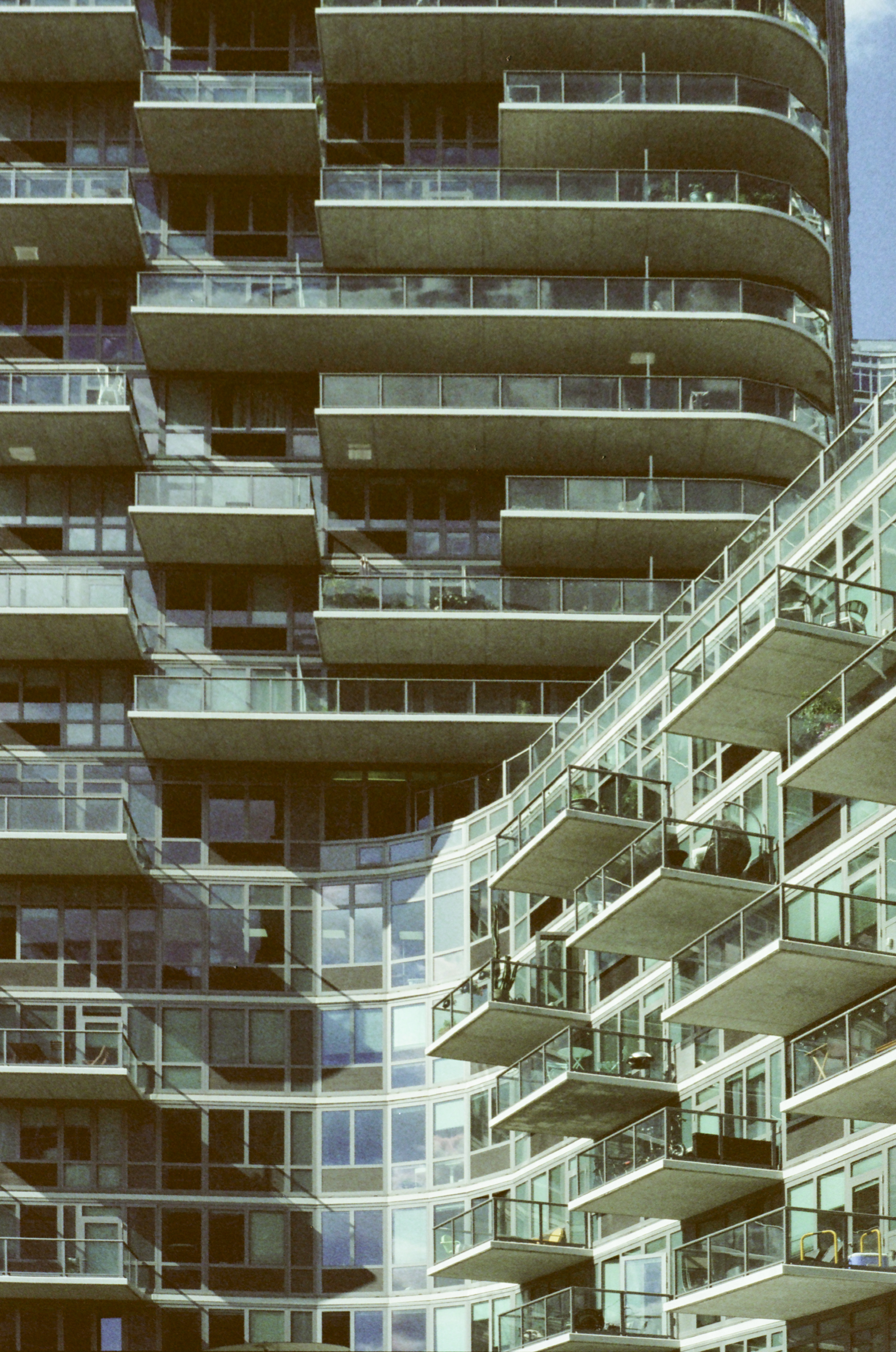
Few New York City neighborhoods have seen a recent explosion of development on the scale of Long Island City’s waterfront. An industrial area throughout the 20th century, Long Island City has undergone a recent transformation into a hub of residential development, spurred by its close proximity to Manhattan and numerous inter-borough subway connections.
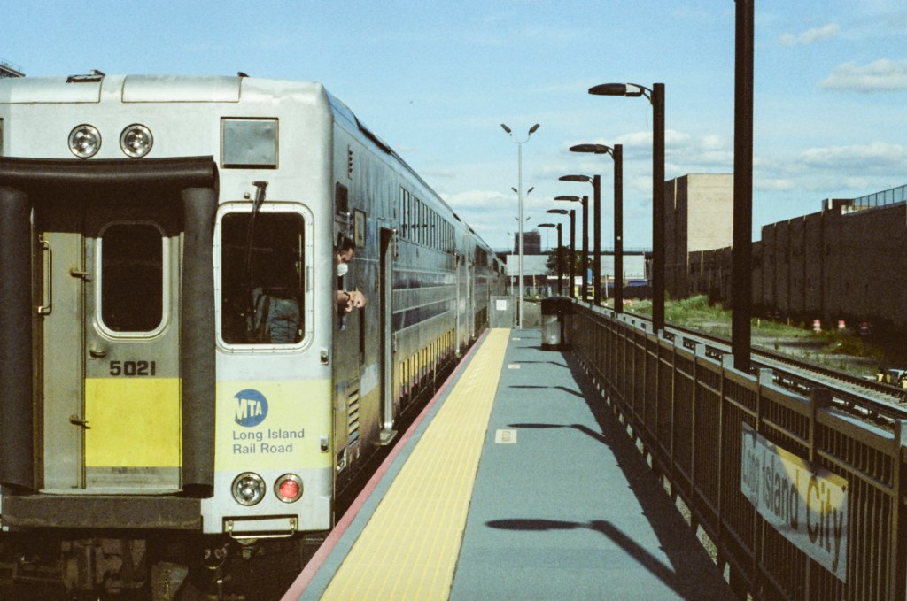
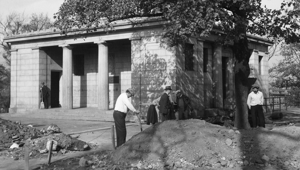
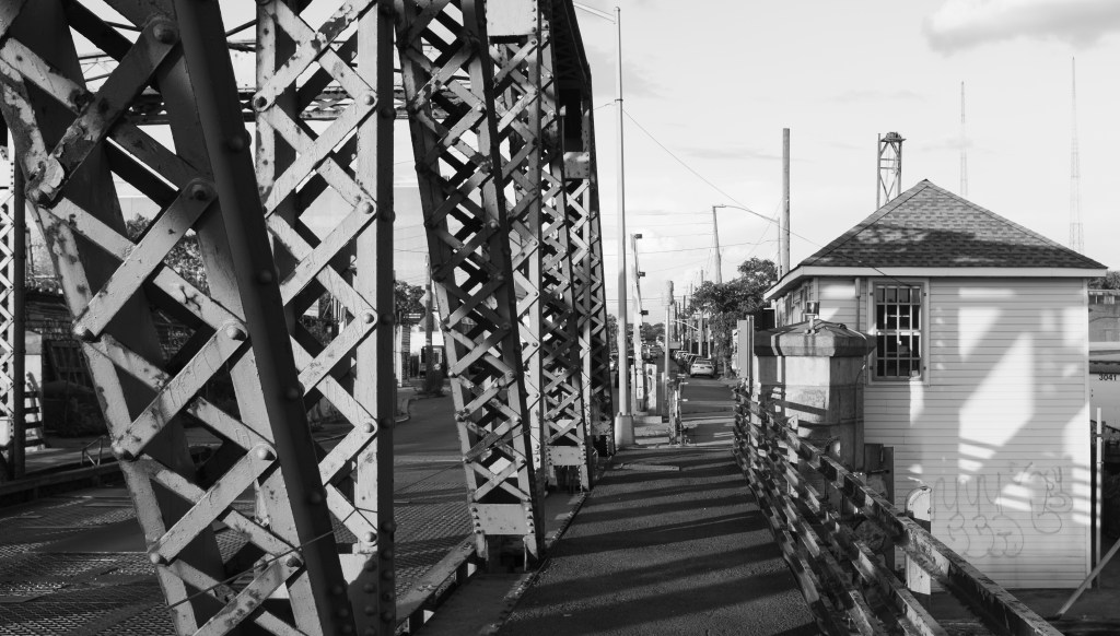
There are few artifacts of the neighborhood’s history still standing. One such artifact is the Long Island City station of the Long Island Rail Road, which is probably New York City’s most-hidden and certainly one of New York City’s least-used railroad stations.
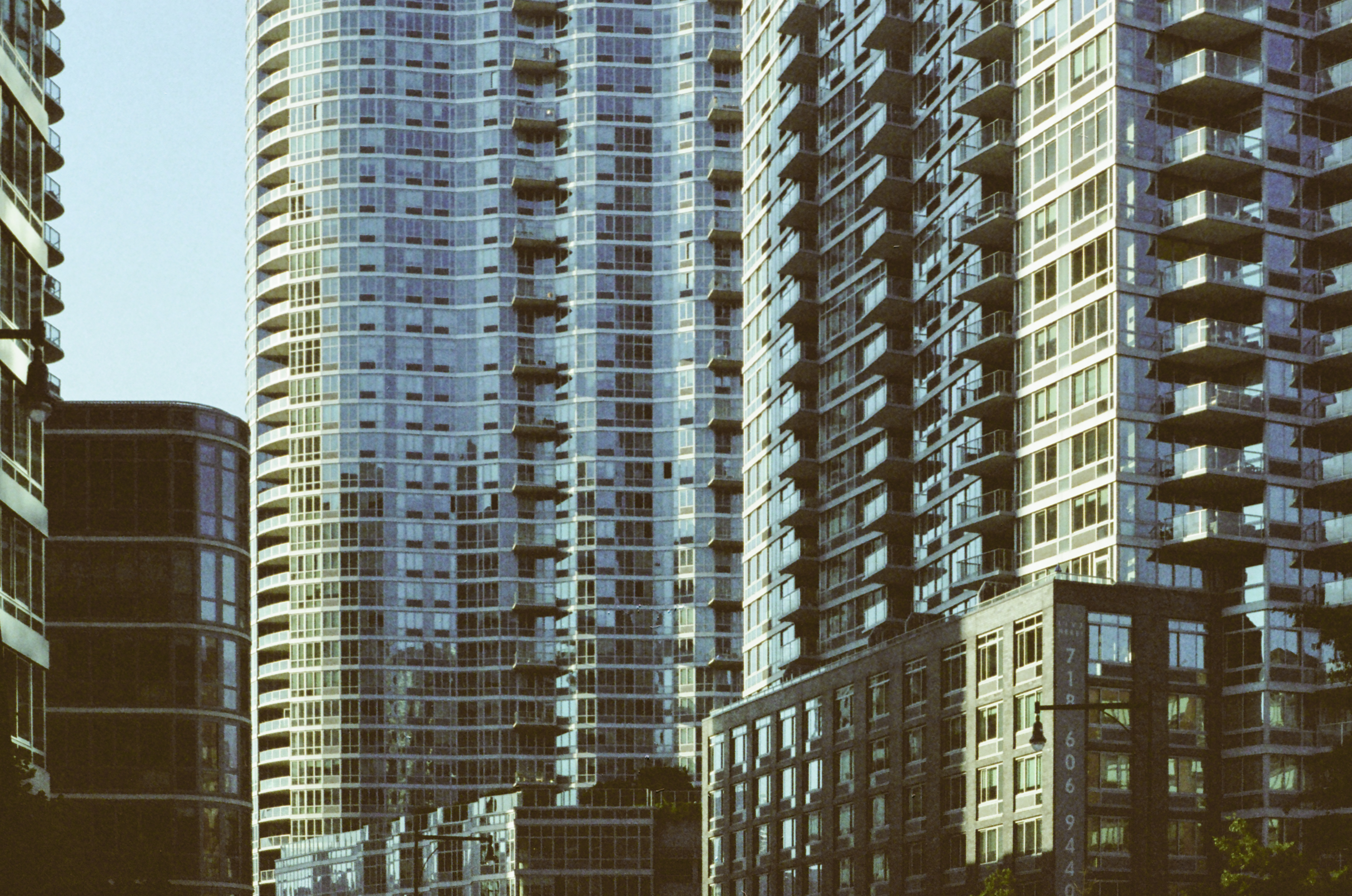
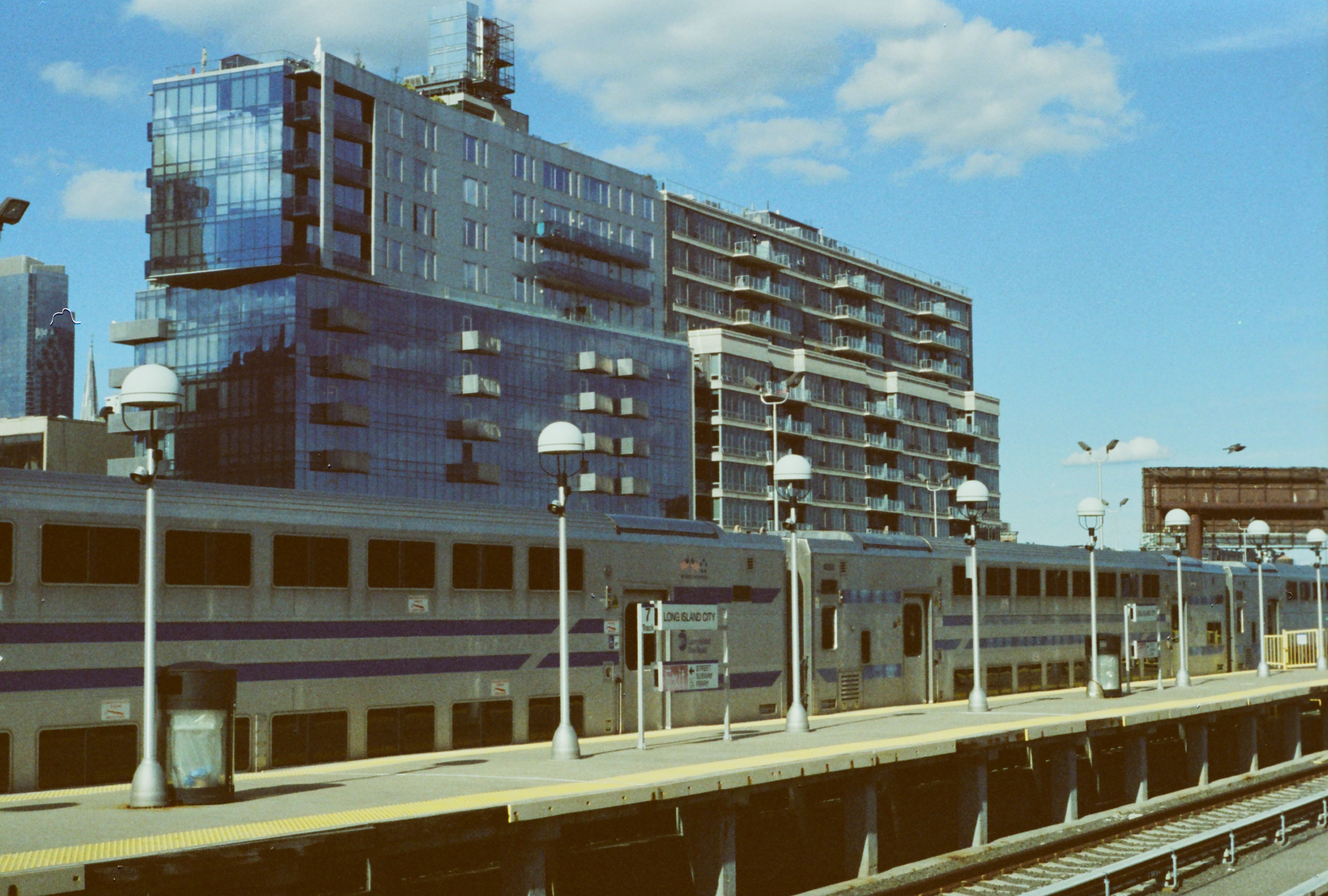
Along Center Boulevard, the closest street to the waterfront, new construction has brought density at a nearly-dazzling scale to Long Island City.
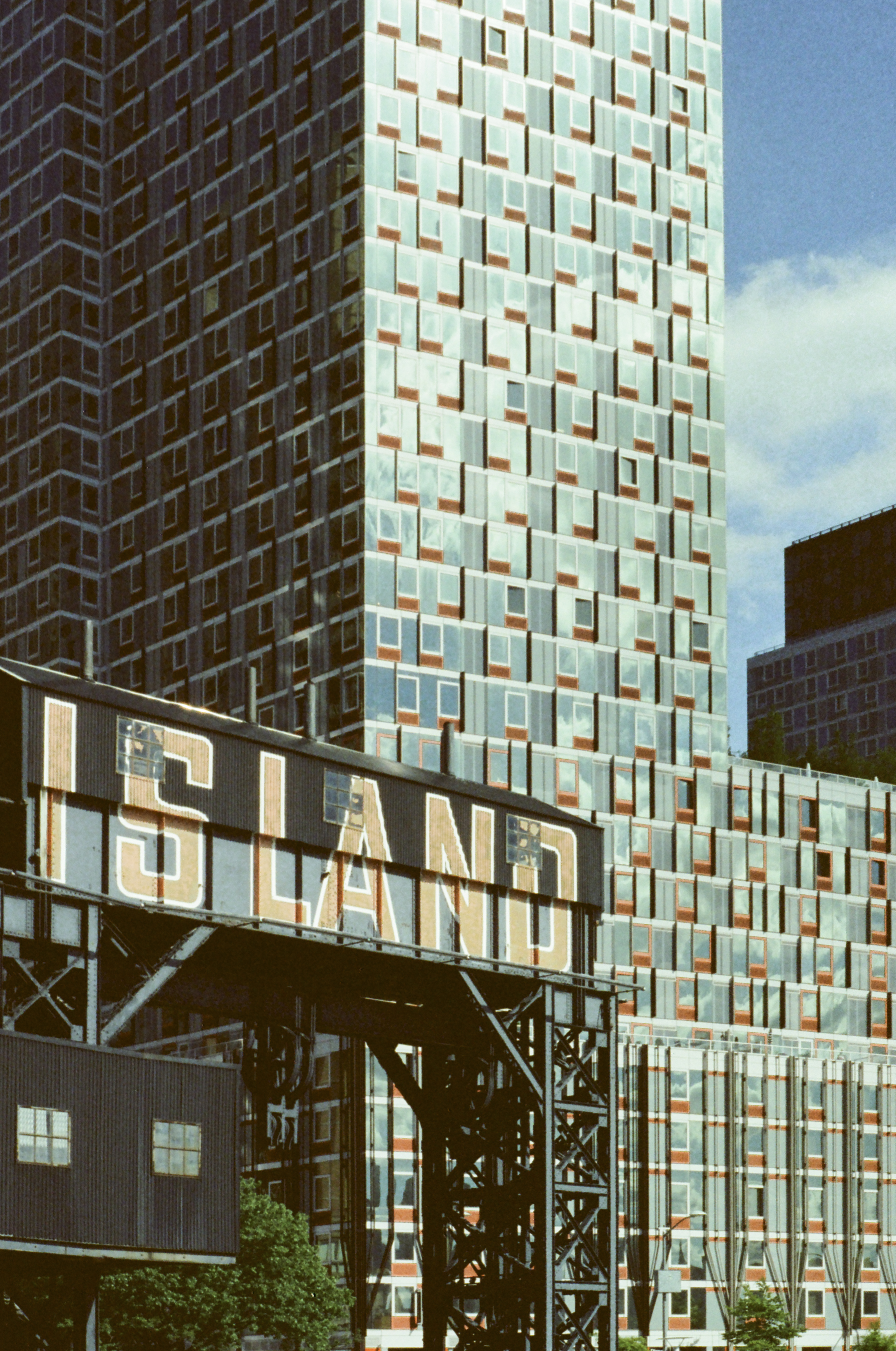
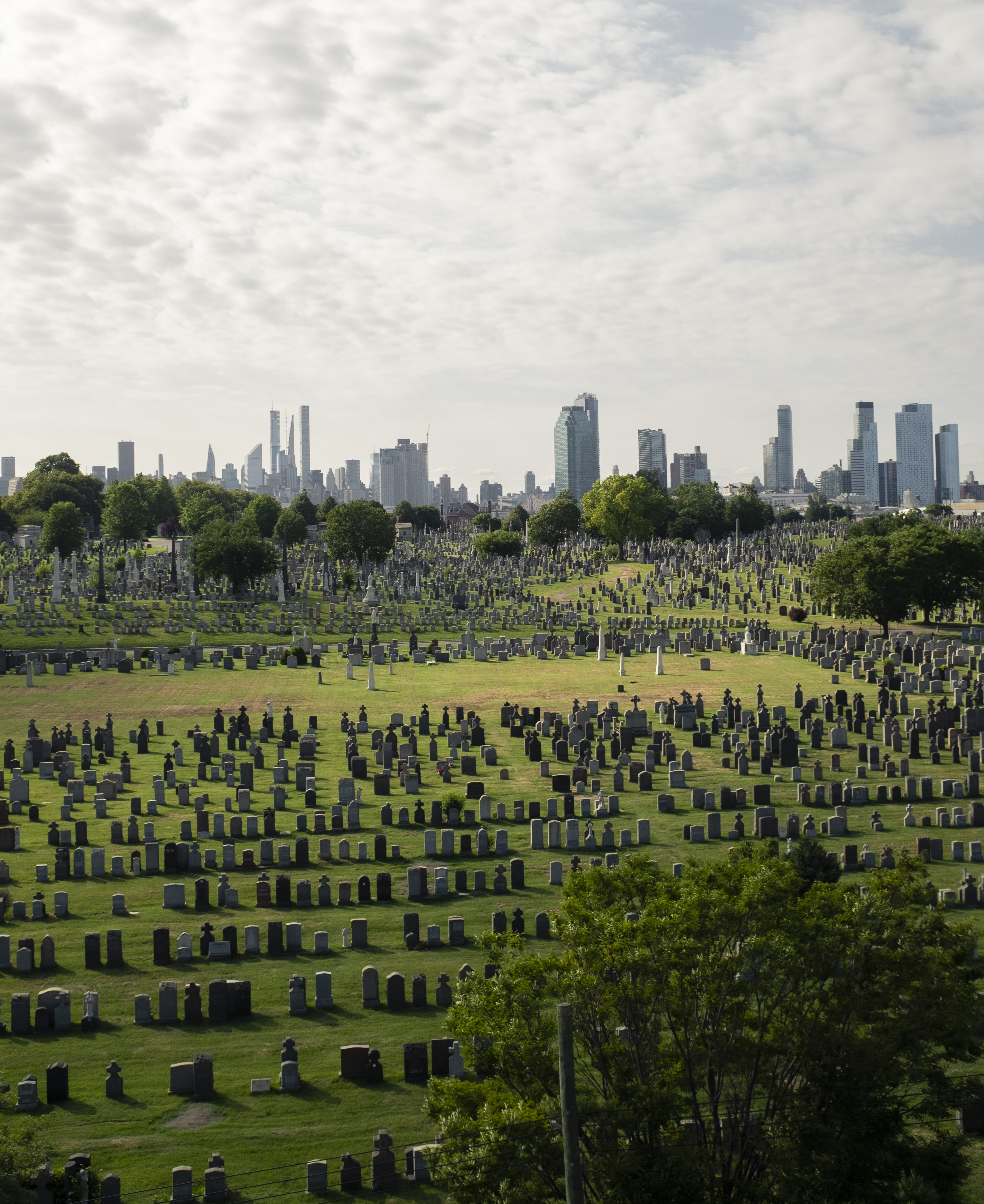
Long Island City still retains a few relics of its more-industrial history, most notably the two gantries labeled “Long Island,” which give Gantry Plaza State Park its name. These gantries controlled the Long Island Rail Road’s car float operation, which transferred freight cars carried on East River barges to railroad tracks for the remainder of their journey across New York City or to Long Island.
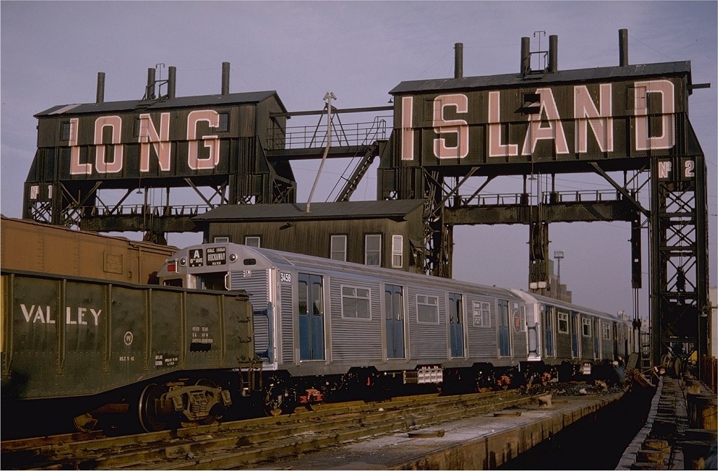
Some of the first shiny, new R32 subway cars were delivered to New York City by Long Island Rail Road car float in 1964. These would have been some of the final deliveries made by car float, as the gantries, and the rail line which led to them, was disused by the 1970s. (Below image credit: Gerald H. Landau, via nycsubway.org, link)
Only a few sections of track remain in Gantry Plaza State Park, which opened in 1998, that give any hint that the waterfront was once the end of a railroad line. The North Shore Freight Branch ran alongside the waterfront before joining the main line of the Long Island Rail Road.
Before tunnels under the East River were opened in 1910, Long Island City was the westernmost reach of the Long Island Rail Road, and passengers transferred to ferries for access to Manhattan. Since the opening of the tunnels and the end of ferry service in 1925, the station, left without a purpose and which now gets very little use, has sat as a monument to an era of very different travel patterns.
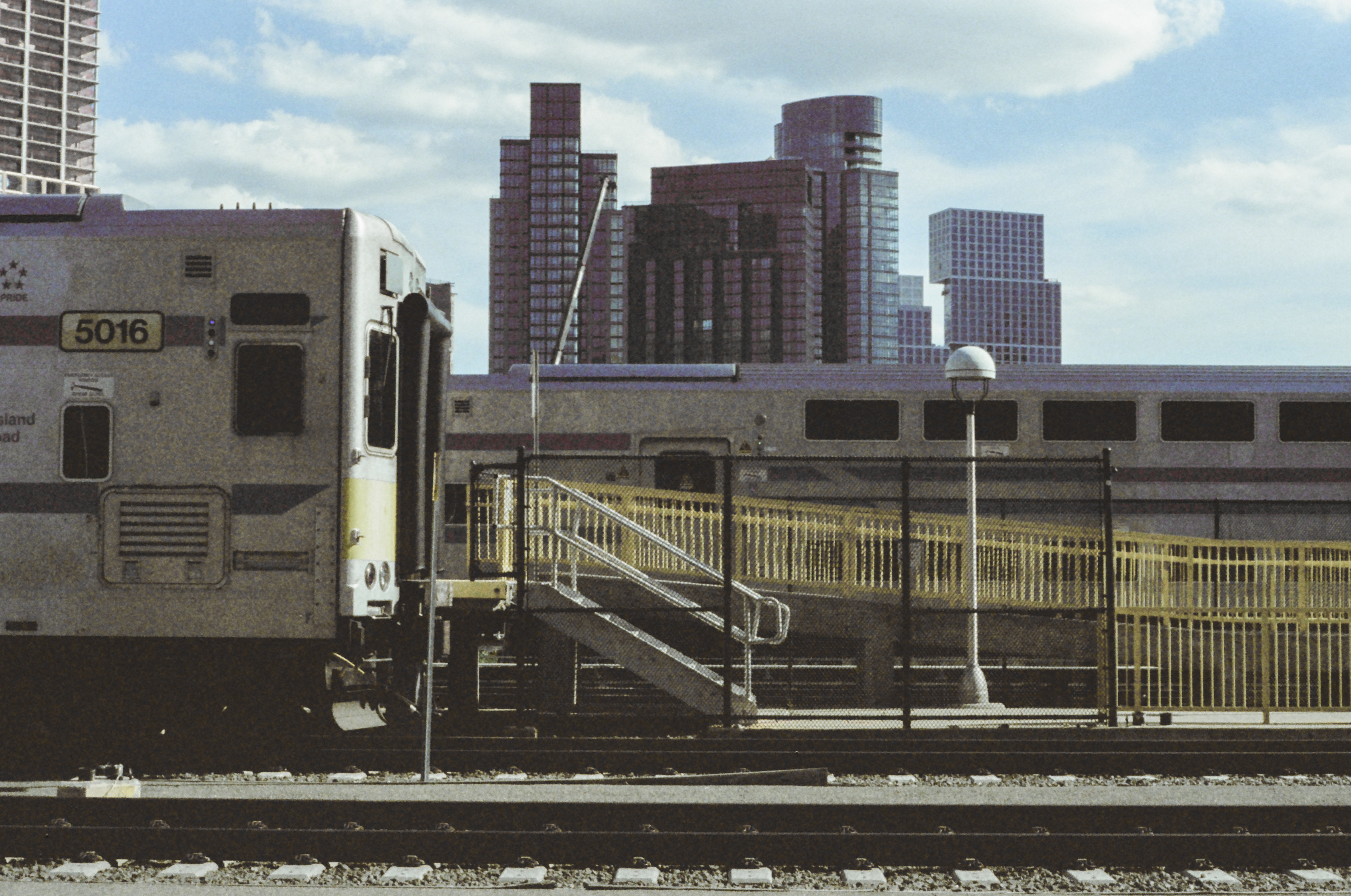
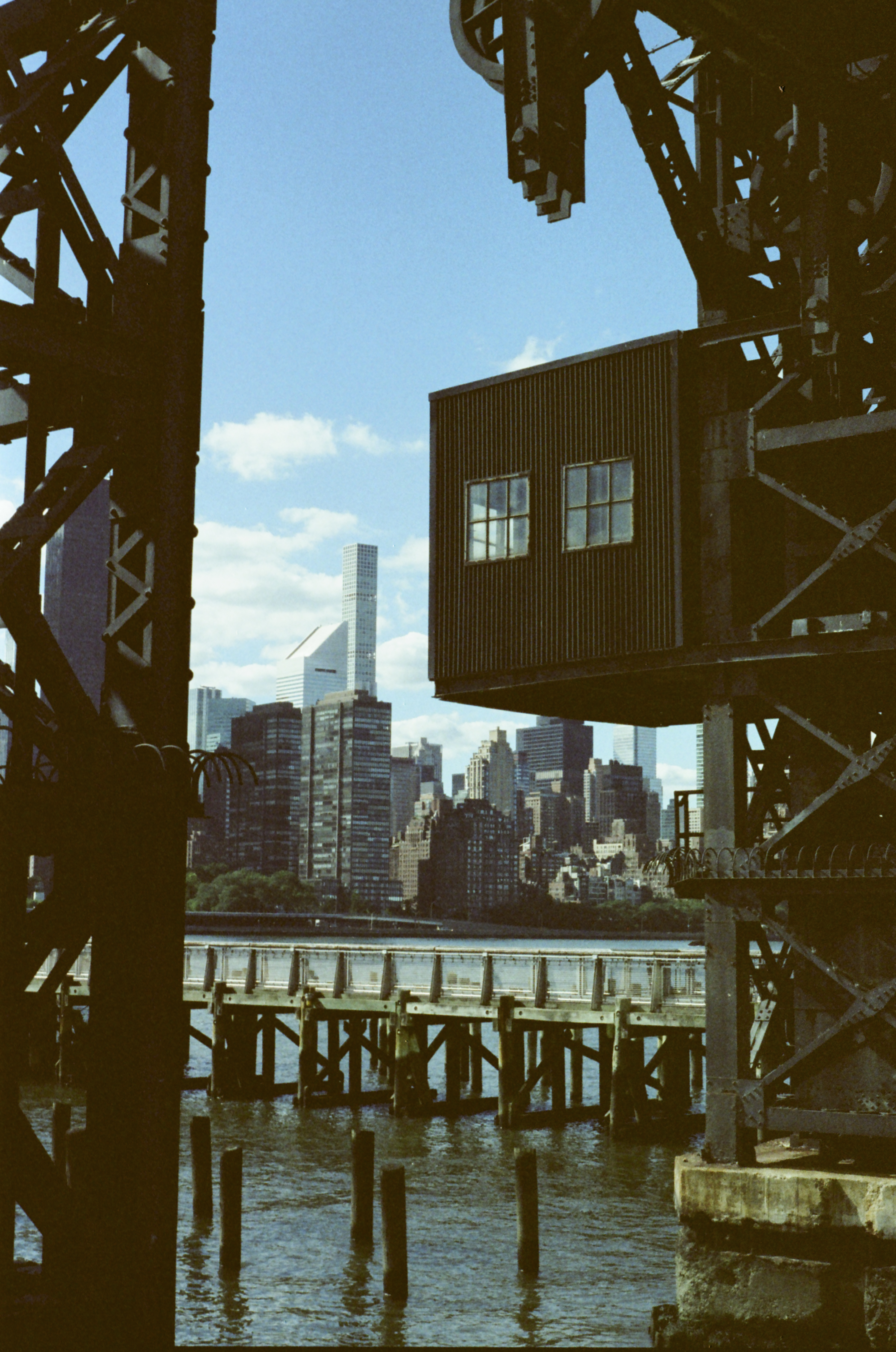
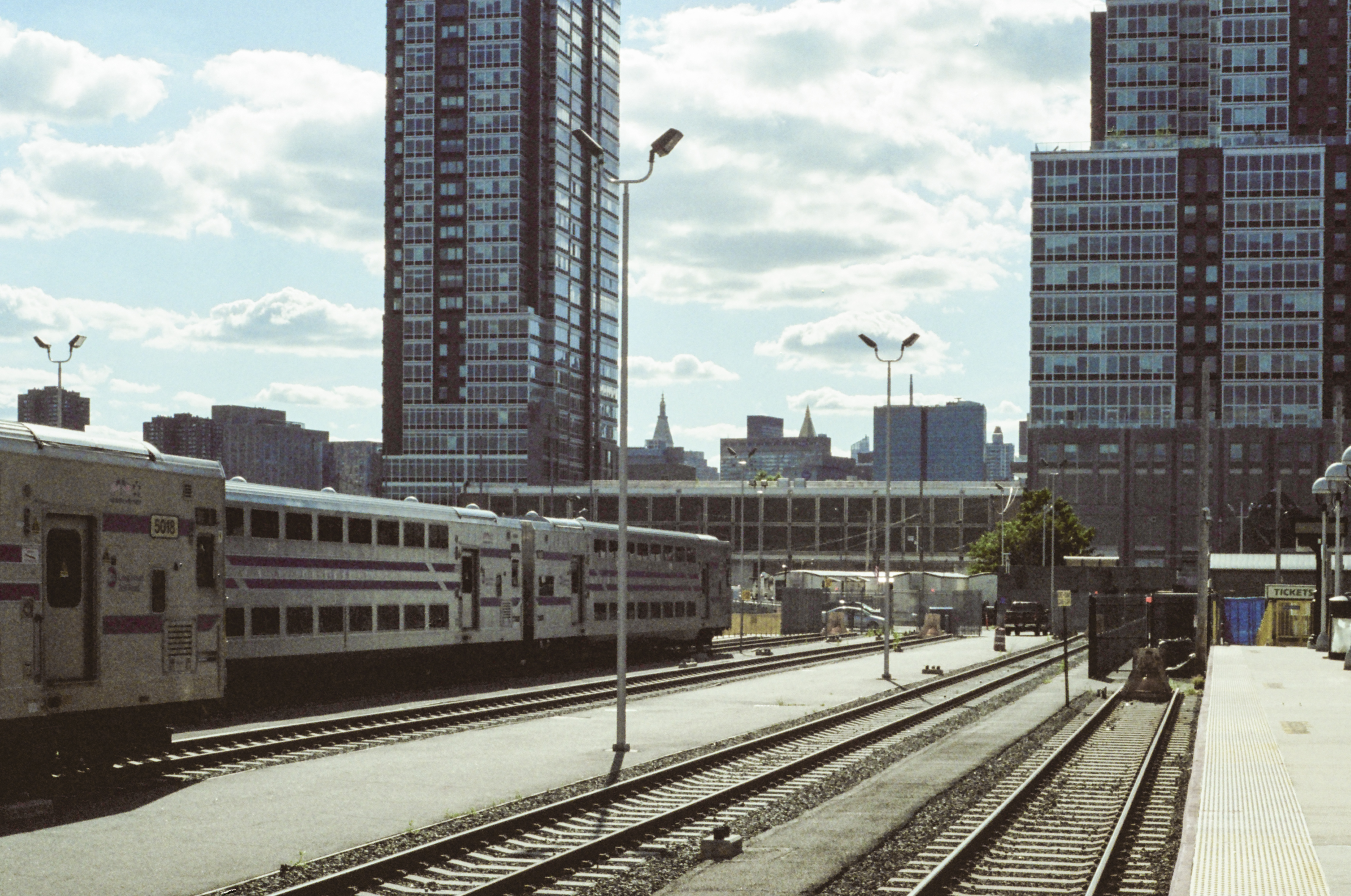
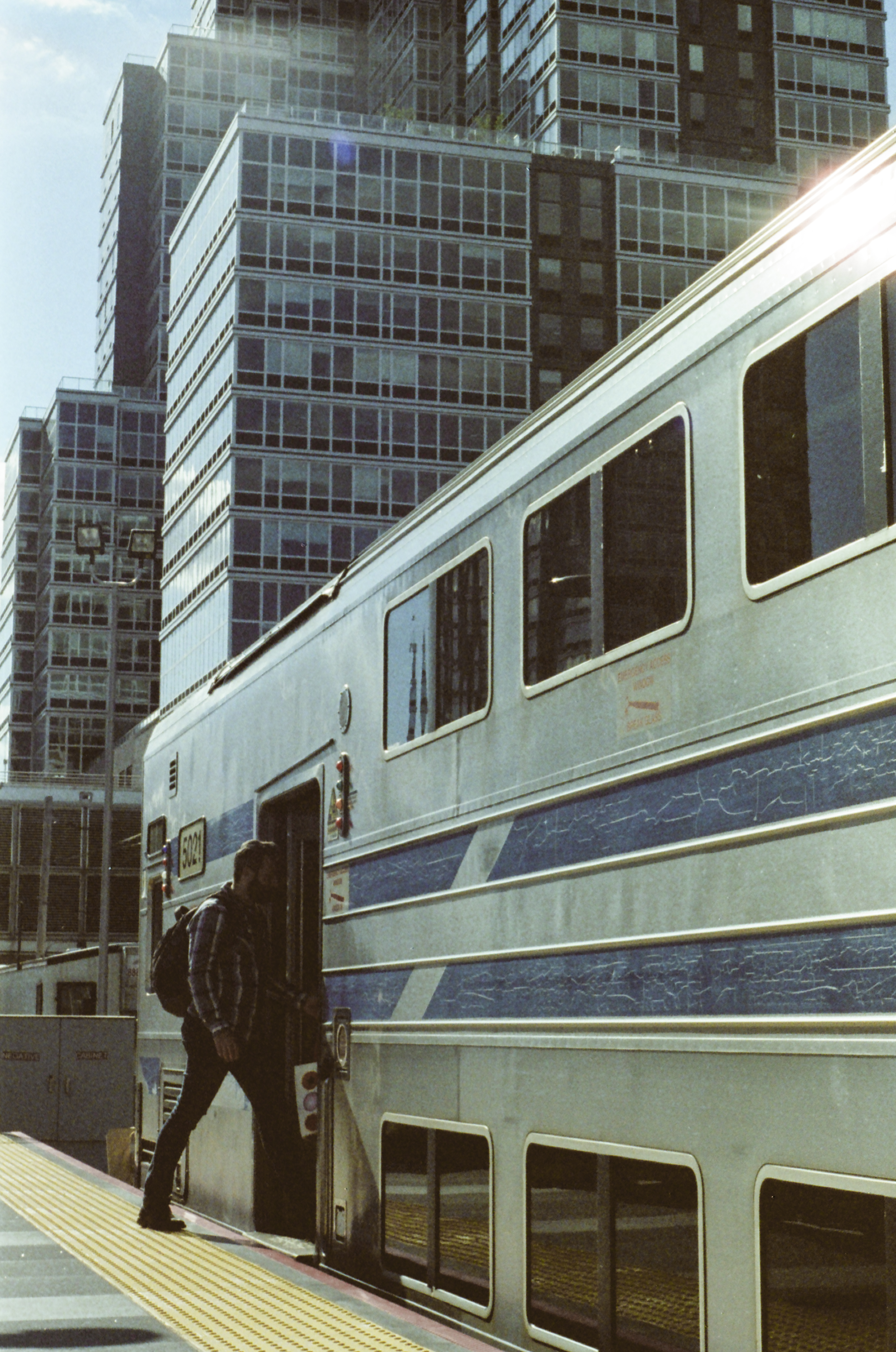
The modern, and growing, skyline of residential towers on the Long Island City waterfront provide a stark contrast to the sleepy train yard and station which sit in their shadow.
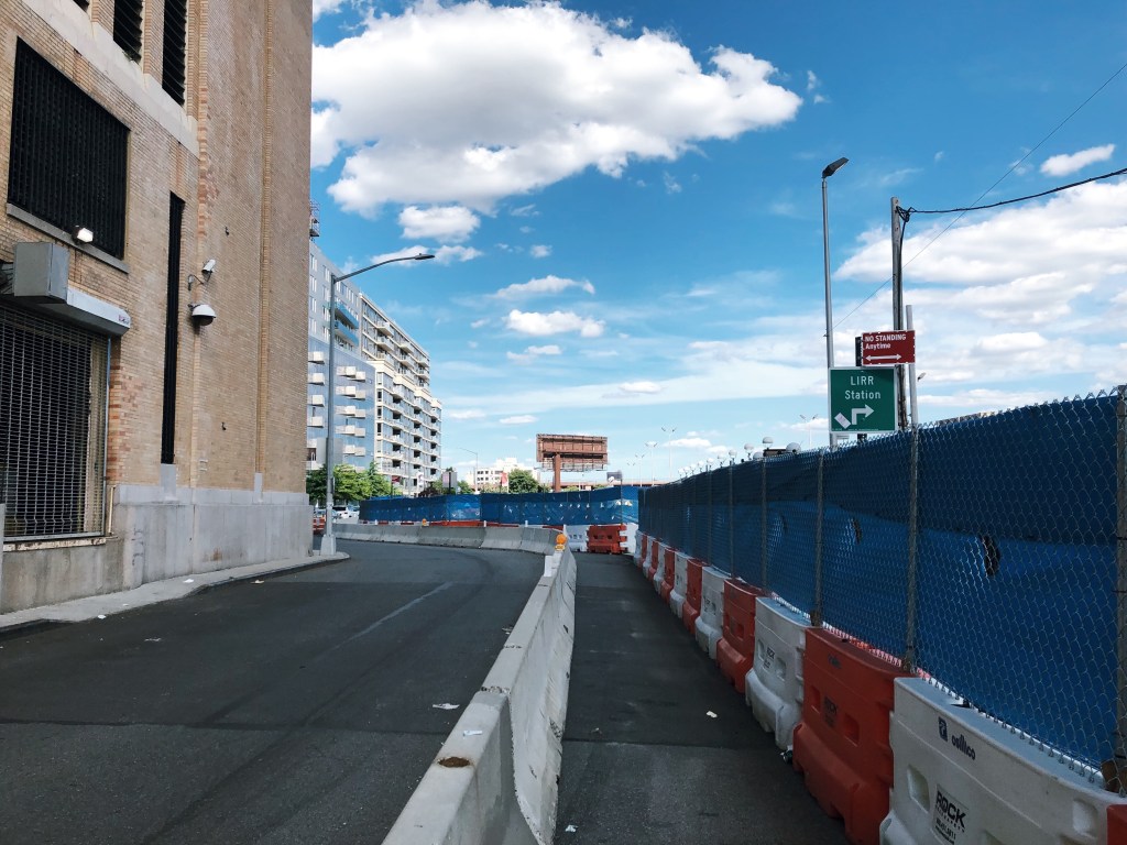
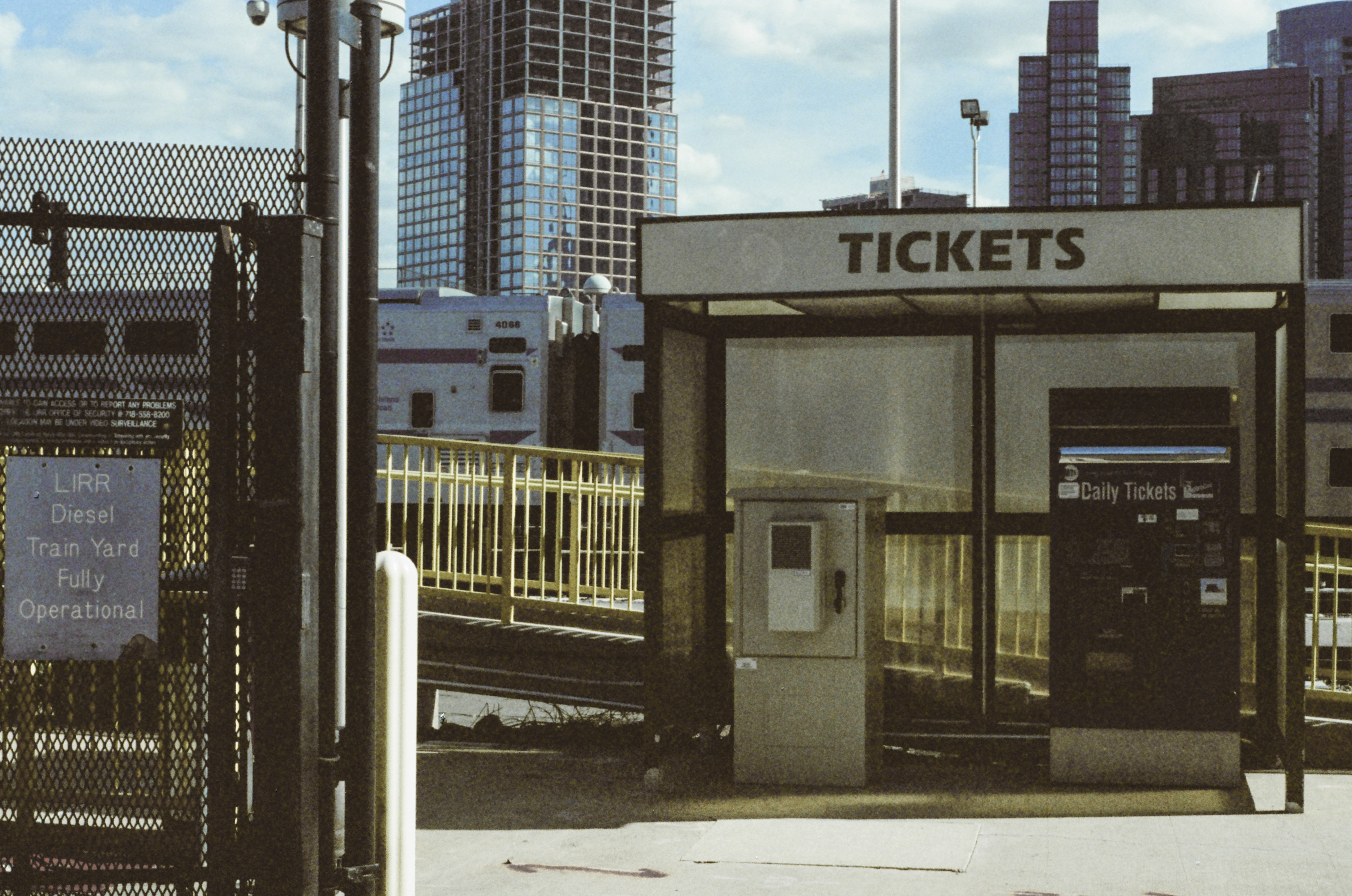
But people who live nearby could be forgiven for not realizing this station actually exists—let alone that they can take a train to or from it. Access to the station (at least right now, this shouldn’t be permanent) is along a temporary sidewalk; a single and easy-to-miss sign is the only confirmation that you are approaching the entrance to a train station.
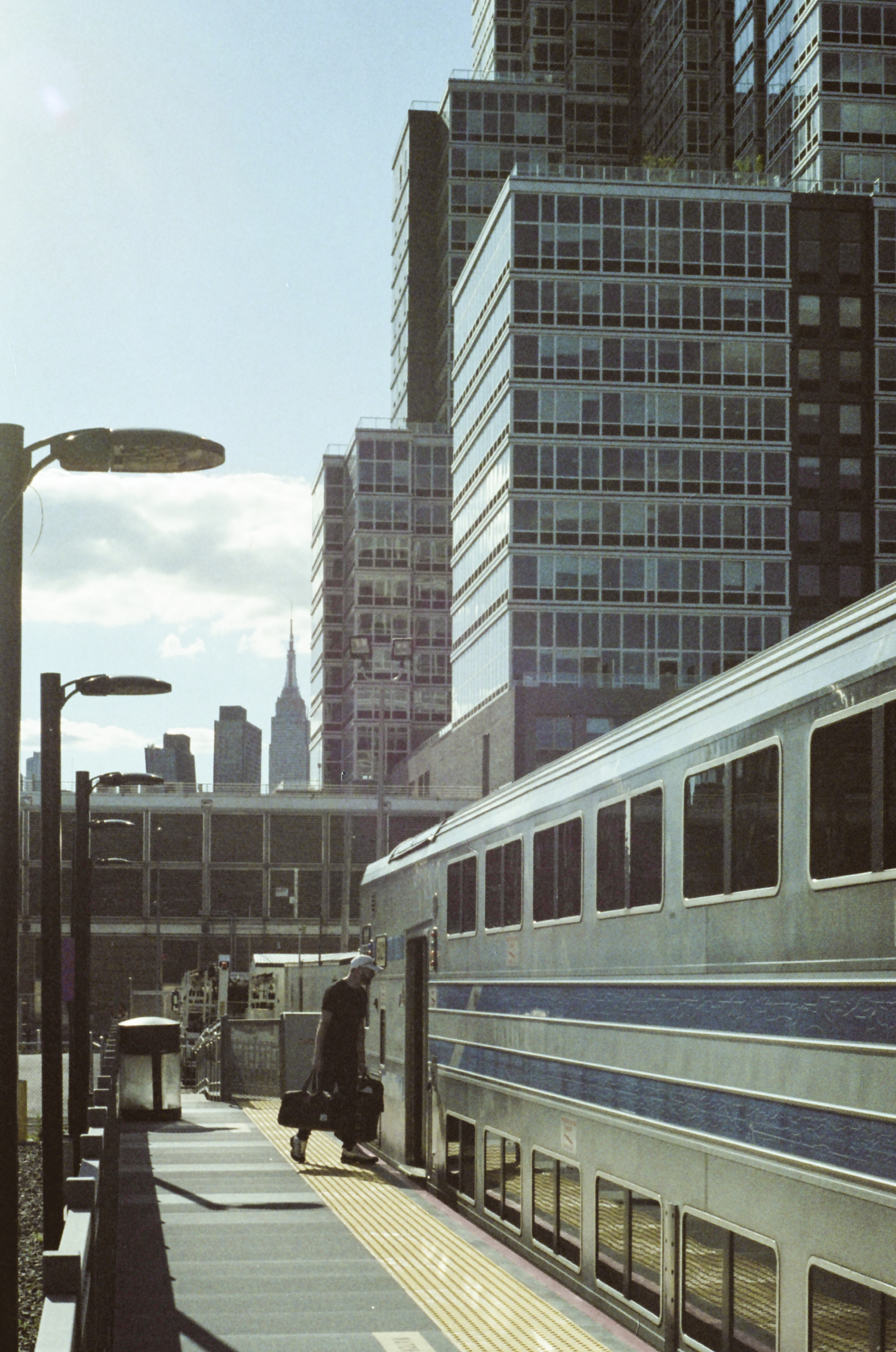
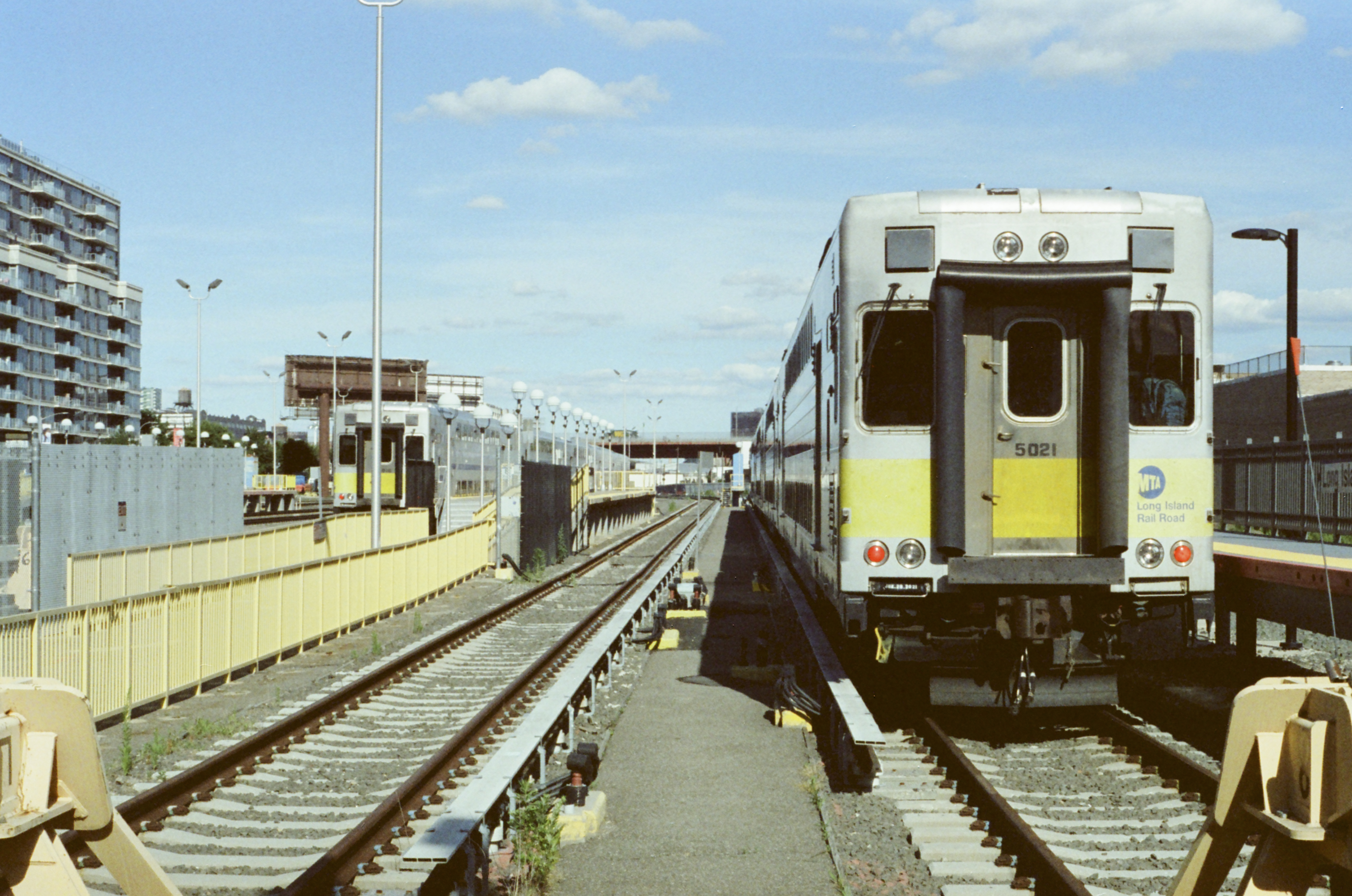
Long Island City is primarily a storage facility for the Long Island Rail Road’s diesel equipment which, because it cannot enter Manhattan, must be stored in Queens between the morning and evening rush hours. Despite this, the station has seen some minor improvements in recent years: the two platforms pictured here are new additions, as is the electrified third rail on these tracks. (Previously, only three non-platform tracks in the yard were electrified).
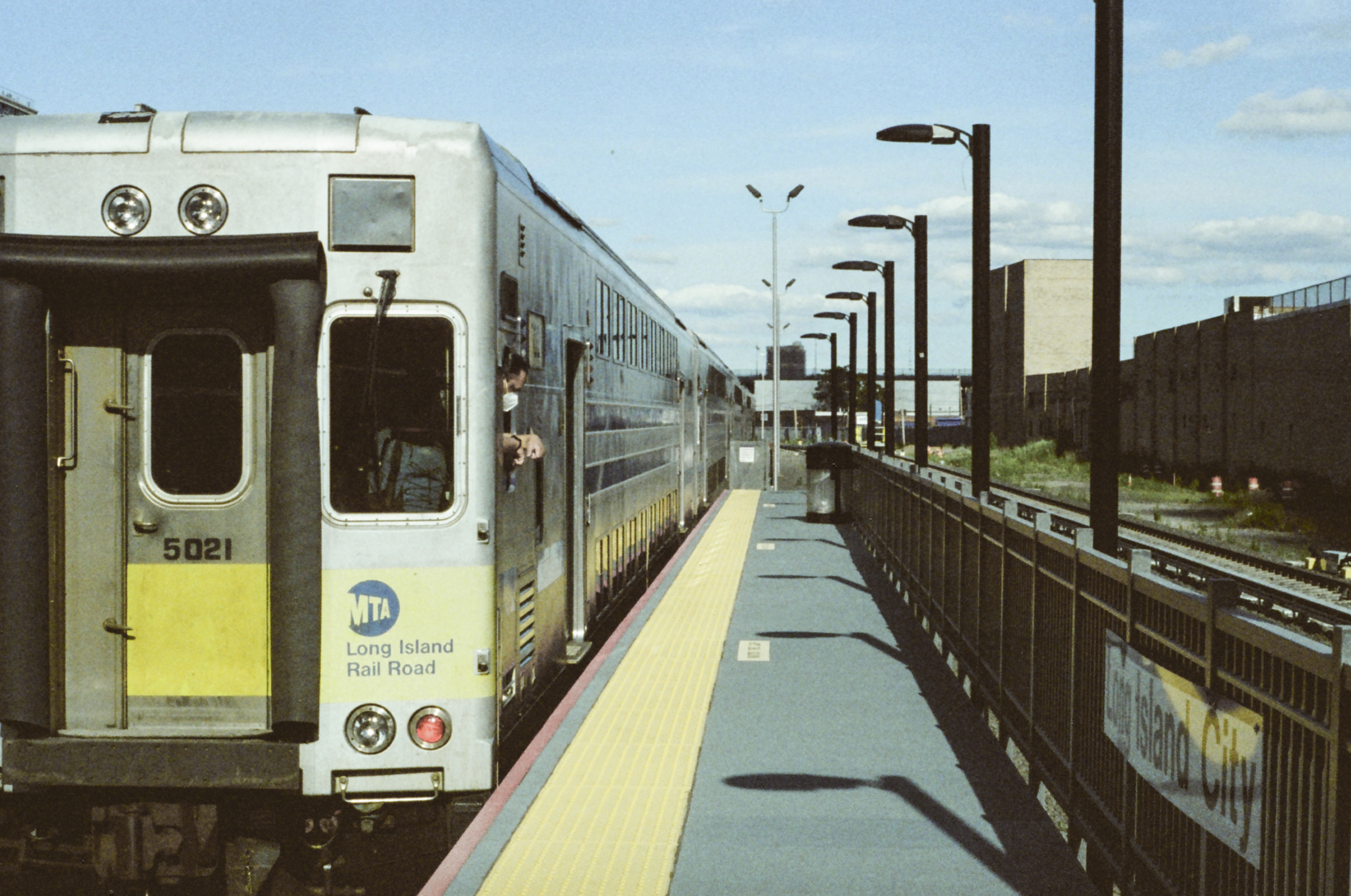
These two platforms are not easily accessed or visible from the current street entrance, and getting to them involves a walk around the perimeter of the yard. However, those platforms were the ones in use on this particular evening.
Nonetheless, the station does see some use: a handful of evening commuters at Long Island City board trains heading east towards Long Island. The number of people living within walking distance of the station has grown tremendously in the past two decades, but the station remains quiet.
This is in large part due to the fact that trains only run to Long Island a few times per day—there isn’t a large Western Queens-to-Long Island commute market, and the Long Island City station has no direct subway or bus connections (and the mediocre pedestrian access shown above).
The Hunterspoint Avenue station, a short distance east, is connected to the subway and, though service there is still limited, it receives significantly more ridership than Long Island City.
Carrying six passengers, the 5:30 to Port Jefferson—one of three trains from Long Island City in the evening—departs the station.
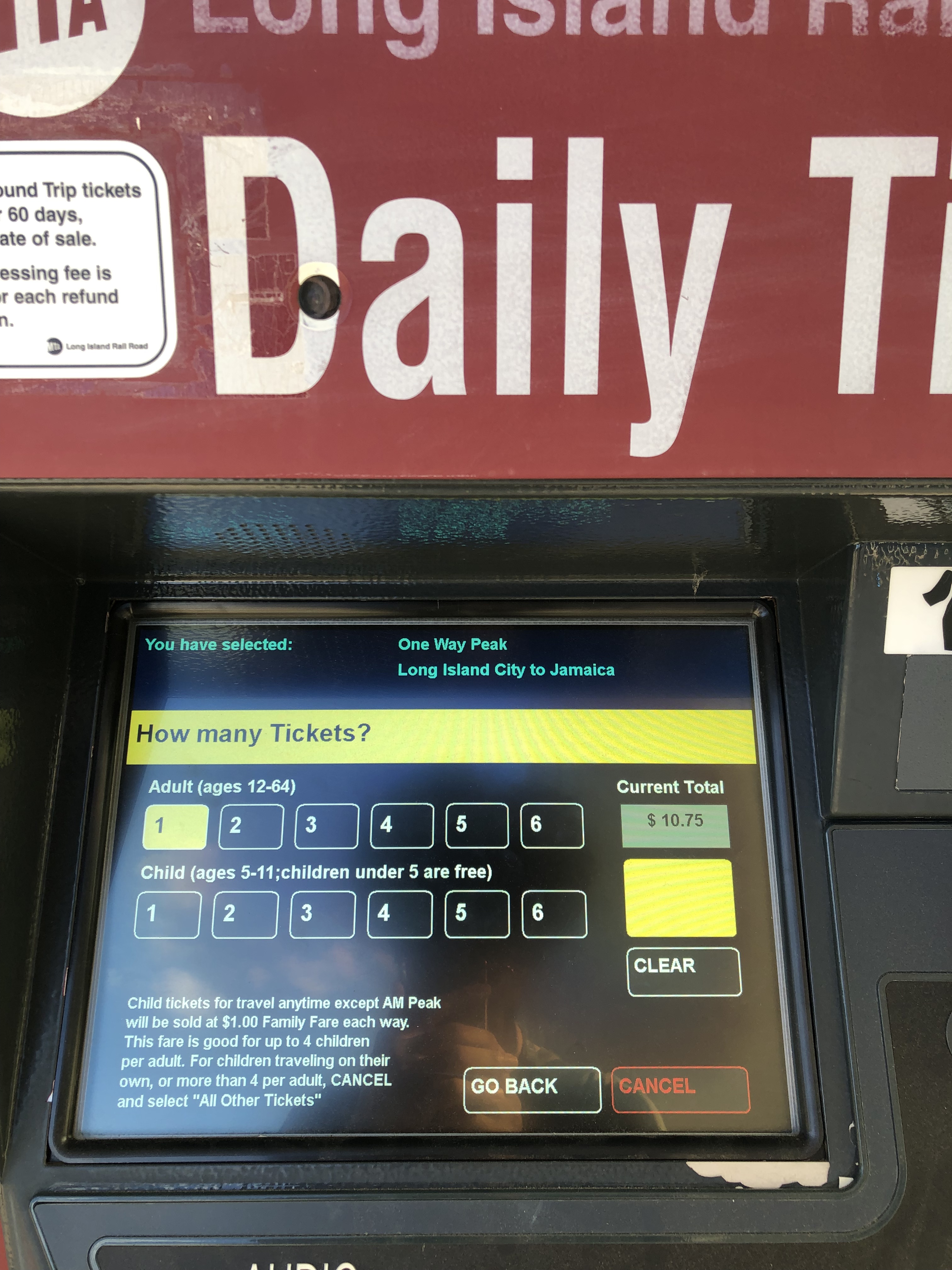
Most trains to and from Long Island City are peak-time trains, and at peak prices, a ticket to Jamaica is $10.50. We should be under no illusion that this station would be packed if tickets were cheaper—but there is almost certainly no world where stations like Long Island City are better used if commuter rail fares stay unchanged.
For as long as the station is important to train storage—which it will be for the foreseeable future—it will likely remain open to passengers, if very seldom-used. It is unique not just in New York City but in the world: there are not many other places where growing urban neighborhoods and near-disused rail stations still coexist.
Whether the Long Island City station will ever be busy again is an open question. Its adaptation—and that of other, similarly-lightly-used urban railroad stations—to New Yorkers’ modern travel needs should be on the minds of regional planners, policymakers, and transit operators as the city continues to grow, and more people hopefully turn to public transit for urban mobility.
Photography Notes
These photos were shot on Cinestill 800T film. Considering that the environment in which these were taken—a very bright, sunny evening—is the precise opposite of what this high-sensitivity tungsten-balanced film was designed for, I’d say it held up quite well. Undoubtedly, though the out-of-place nature of this film choice is evident in a number of the photographs—because of that, I wouldn’t consider this a totally fair look at what this film can really do!
Nearly six months ago, Pittsburgh’s Fern Hollow Bridge collapsed into Frick Park. The collapse of the bridge, which severed one of Pittsburgh’s most important traffic arteries, drew the nation’s attention to the sorry state of infrastructure around the country. In the wake of the bridge collapse, the urgency of passing legislation to fund improvements to infrastructure was heightened—not least by the President himself, who had already been due to speak in Pittsburgh on the day of the collapse about the importance of infrastructure investment.
When the Bipartisan Infrastructure Law championed by President Biden was passed in November 2021, many breathed a sigh of relief: America’s infrastructure was finally going to be fixed. But this relief, unfortunately, is shortsighted. Our infrastructure problem, particularly regarding automobile infrastructure like highways and road bridges, goes beyond just long maintenance backlogs. The problem is not justthat we have too much dilapidated automobile infrastructure. The problem is that we have too much dilapidated infrastructure because we simply have too much car infrastructure.
The Fern Hollow Bridge: A Casualty Of Urban Decline
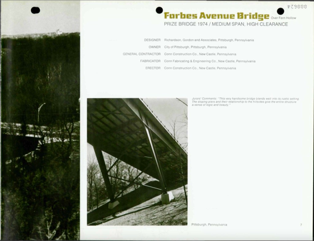
That Pittsburgh was the location of such a high-profile failure of public infrastructure was particularly salient. Pittsburgh is famous for its hundreds of bridges, carrying roads and rails across the region’s steep valleys and ravines. Pittsburgh is also symbolic of the urban decline that has imperiled so much of the nation’s infrastructure. The Fern Hollow Bridge opened in 1973, replacing an older bridge at the same location dating from 1901. The year after its completion, it was named a Prize Bridge by the American Society of Civil Engineers. On a small level, it is symbolic of the optimistic attempts at modernizing the city that were underway in the 1970s. But this decade was the beginning of an incredibly challenging period for the city and region. During the 1970s, the region’s population was in the beginning of a precipitous decline from which it has yet to recover. The 1970 Census was the first one which recorded Allegheny County’s population as lower than the previous Census, and no subsequent Census would record any population growth in the county until the most recent, in 2020.
Glowing praise for the then-new Fern Hollow Bridge from the American Society of Civil Engineers in 1974. (From full booklet here).
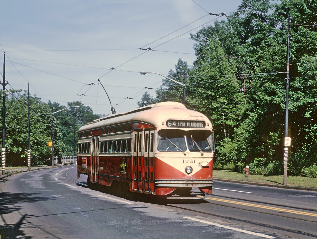
The original Fern Hollow Bridge stood from 1901 to 1971 and carried automobiles and streetcars, such as this #67 streetcar exiting the bridge in 1967. (Photo credit: Roger Puta, link)
The original Fern Hollow Bridge, featuring a #67 streetcar, in 1967 (left, link) and glowing praise for the then-new Fern Hollow Bridge from the American Society of Civil Engineers in 1974. (right, from full booklet here) and
For the city of Pittsburgh itself, the period of decline had begun before the 1970s. Having already lost 10 percent of its peak population between 1950 and 1960, the city lost another 13 percent between 1960 and 1970, and a staggering 18 percent between 1970 and 1980. Today, the city remains just under half (302,971 recorded in 2020) of its peak population (676,806 recorded in 1950). Pittsburgh’s population decline hasn’t even stopped yet, though it has hopefully been stemmed. (The population loss between 2010 and 2020 was a minimal—perhaps encouraging—0.9 percent). Thanks to suburbanization, Allegheny County has lost a smaller, but still sizable, share of its population since 1970, with 22 percent less population today (1.25 million) than it had in 1970 (1.6 million).
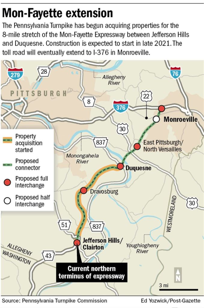
Despite the loss of population, the amount of automobile infrastructure in the region continued to grow. The Downtown-to-North Hills Parkway North opened in 1989, the loop of Interstate 376 to serve Pittsburgh International Airport opened in 1990, and construction on the final section of the Mon-Fayette Expressway is supposed to begin sometime this year. The upshot of this is that the Pittsburgh region has the automobile infrastructure for a region with a much larger population, and a much larger tax base to fund its maintenance. The Pittsburgh region is far from the only one in America that can claim this story. Across the post-industrial cities and towns of the Northeast and Midwest, there are likely many more miles of roadways and bridges than can be supported by those regions’ current populations. If we want to get the condition of our infrastructure under control, we need to start with infrastructure that is appropriately scaled to the regions they serve today.
We’re still building new, large-scale automobile infrastructure despite minimal (or no) population growth! This is the soon-to-be under construction extension of the Mon-Fayette Expressway further into Allegheny County. (link).
I am certainly not the first person to make this point—it was pointed out by severalonTwitter (and probably others I missed!) in the immediate wake of the Fern Hollow Bridge collapse. What is important to add here is that Pittsburgh already knows exactly how to transform redundant infrastructure for cars into quality mixed-use spaces for people. Several years before the Fern Hollow Bridge collapse, Pittsburgh successfully converted a roadway facing structural issues into a car-free path through one of the city’s largest parks.
The Pocusset Street Transformation
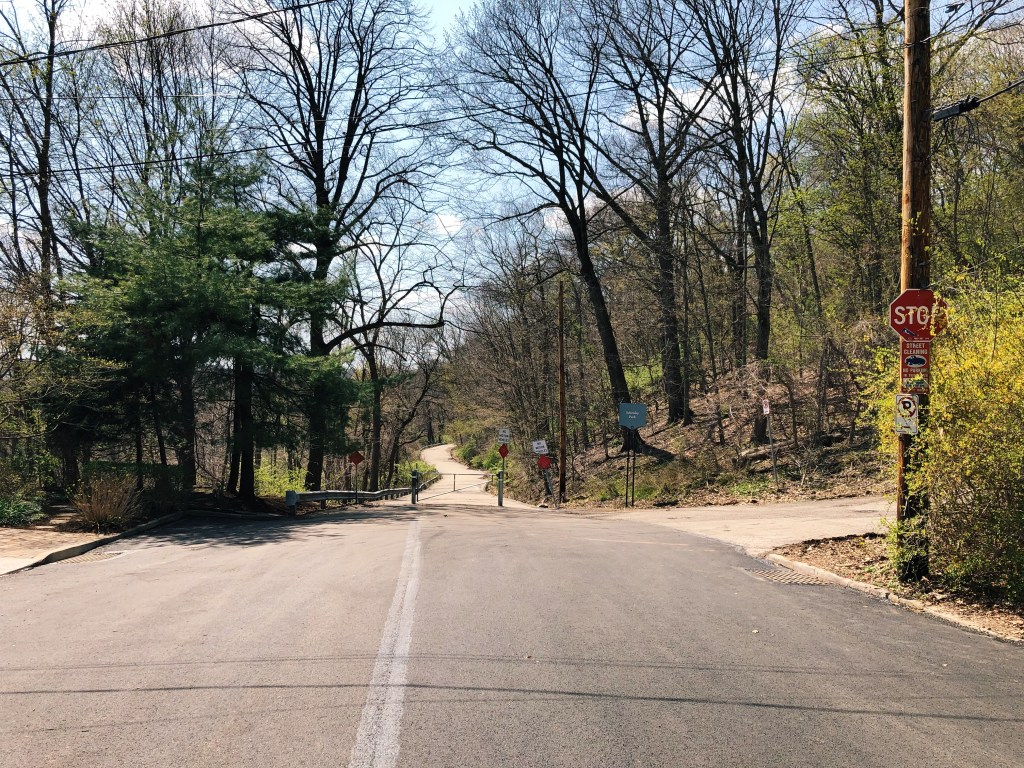
Entrance to the car-free section of Pocusset Street in Squirrel Hill, with modal filter, April 2022.
Pocusset Street is a quiet residential street at the edge of the Four Mile Run valley, which separates the northern and southern sections of Squirrel Hill. Until a few years ago, part of the road also connected Squirrel Hill to Greenfield through Schenley Park, serving as a shortcut for the busier roads through the park. (Local cycling advocacy group BikePGH noted that the road’s narrow width and twisty route through the park made it unsafe for pedestrians and cyclists). In 2012, inspections found that the 0.3-mile section of Pocusset Street in Schenley Park, which carries the road on an embankment high above the valley, was not structurally sound. Storm drains were obstructed, and parts of the embankment were washed out, and one part of the roadway was “undermined by a cavity of between 12 and 15 feet.” The problematic section of Pocusset Street was closed to traffic while the city’s Department of Public Works (DPW) considered rebuild options to allow continued car traffic.
The necessary rebuilding work was estimated to cost as much as $700,000, money which the DPW did not have. As an alternative, the city floated a plan to reopen the street for pedestrian and bicycle use only, sparing the cost of a full rebuild while opening a new, safe walking and cycling connection between Squirrel Hill, Greenfield, and Schenley Park. The DPW chose to pursue this plan, setting a first-in-Pittsburgh—and possibly the country, according to BikePGH—example of closing part of a street to car traffic and reopening it for people.
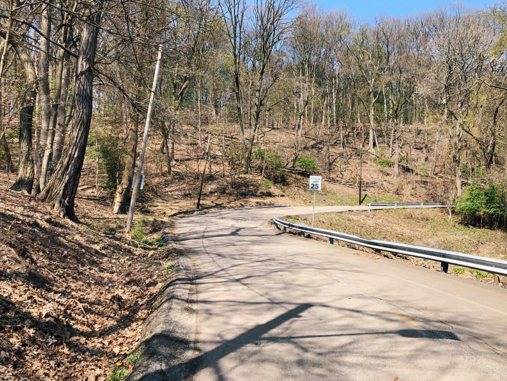
Looking east along Pocusset Street in Schenley Park, April 2022.
In 2014, Pocusset Street reopened as a car-free roadway. The city resurfaced the road, installed new lighting, painted new demarcations for pedestrians and cyclists (which have faded quite a lot) and, importantly, installed “modal filters” (the fancy term for barriers) at each end to protect users from vehicles. The nature of the street’s route through the park and relatively-narrow width, both large detriments when it carried car traffic, make it very well-suited and pleasant as a mixed-use path. Its connection to the rest of Schenley Park on one end means that residents of Squirrel Hill can access Schenley Park, and others can travel across it, without walking or cycling on the higher-traffic roads in and out of the park. Walking Pocusset Street today, it is difficult to believe that was a shortcut for car traffic not so long ago—I imagine that future car-free streets, despite how important they may seem to traffic today, would quickly feel the same.
The Greenfield end of Pocusset Street (the Greenfield Bridge and entrance to Schenley Park on Greenfield Road are immediately behind), April 2022.
Right-sizing Pittsburgh’s Infrastructure
In May, Pittsburgh Mayor Ed Gainey announced the beginning of a “bridge asset management program,” to assess of the condition of city-owned bridges and develop a plan for funding crucial repairs. Across Allegheny County, dozens of bridges are already considered by the Pennsylvania Department of Transportation (PennDOT) to be in “poor condition.” On top of those, Pittsburgh and Allegheny County contain many more miles of roadway and lots more supporting structures, like the embankment carrying Pocusset Street, that are also in need of attention. Suffice to say that the Pittsburgh area’s maintenance backlog is long and expensive, and the kinds of infrastructure issues discovered on Pocusset Street—as well as the high cost for their repair—likely foreshadow the issues that will be unearthed by Mayor Gainey’s new initiative. The Department of Mobility and Infrastructure (DOMI), which took over some of the functions of DPW in 2017, has serious issues with short-staffing and administrative capacity according to recent reporting, adding to the already-large challenge of keeping the city’s decaying infrastructure standing.
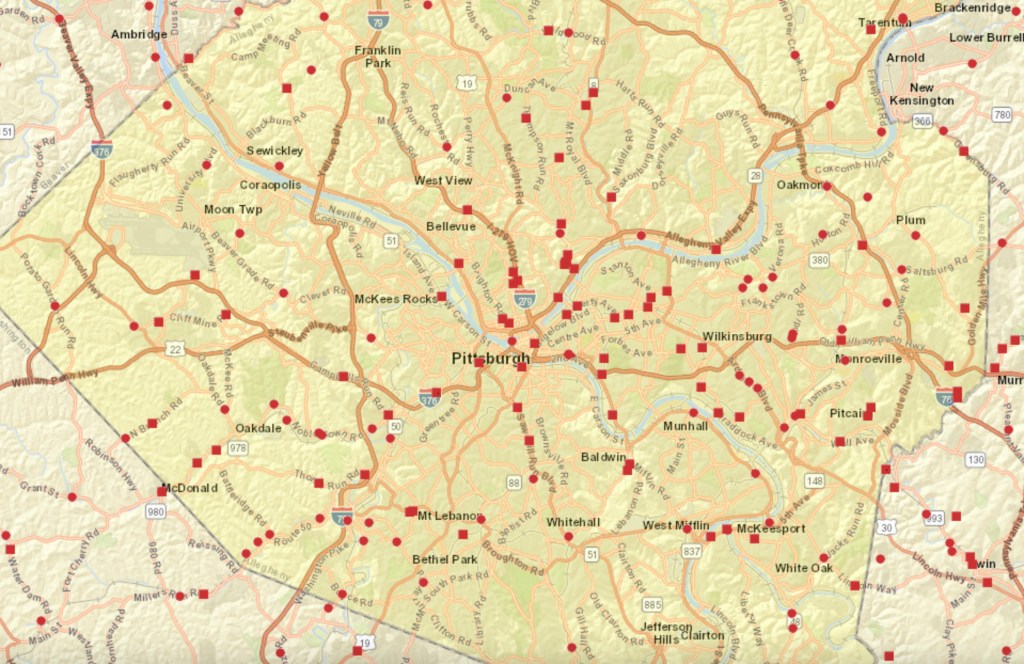
Bridges in & around Allegheny County in “poor condition.” State-owned bridges depicted with a circle; local-owned bridges with a square. From Pennsylvania DOT GIS (link).
The combination of the high cost of infrastructure renewal and the lack of capacity to carry it out leads to the question of whether rebuilding all of the road infrastructure in need of attention to support current—let alone higher—levels of car traffic is a worthy goal at all. The fact that the Pittsburgh region’s automobile infrastructure is oversized relative to its population should be a compelling enough case for the city government to consider whether its responsibilities in maintaining automobile infrastructure can be scaled back. That is before we come to the imperative for all municipal governments to promote a shift away from automobile journeys wherever possible. In its Climate Action Plan, the Pittsburgh Department of City Planning has set the goal of reducing both transportation-related emissions and vehicle miles traveled in Pittsburgh by 50 percent by 2030. This is an ambitious goal that the city should aim to meet, but for this to be possible, the city must make it safer to get around the city without a car. The best, and proven, way to do this is to provide safe, traffic-free routes for those walking, cycling, or using other mobility devices—not expand capacity for car traffic (which, as we know, will encourage an increase in car journeys).
The car-free transformation of Pocusset Street should serve as a model of how DOMI can use redundant car infrastructure for the benefit of the city. In particular, where sections of road or bridges carry low traffic, have nearby alternatives, or would fit neatly into the planned bike network, the city should convert those to car-free roadways. Doing so across Pittsburgh would be a definitional win-win for the city, which could instead use precious infrastructure funding for more projects—such as improving sidewalks or sewers—and would help Pittsburgh achieve its climate aims. There is every reason to believe that more car-free streets would be popular: events like Pittsburgh OpenStreets prove the demand for more open spaces in the middle of the city, and people should have access to such spaces year-round, instead of for a few days per year.
That said, a car-free conversion will not be the answer to the Fern Hollow problem. The Fern Hollow Bridge will be (and must be) replaced, though ideally, the new bridge will be friendlier to non-motorists than PennDOT’s current proposal. But as the city takes stock of the full extent of its infrastructure problems, it should take the opportunity to stop holding on to a built environment intended for the last century—it should instead reimagine Pittsburgh’s infrastructure so it is built for the city of 2022 and beyond.
More car-free streets like this would be an asset to Pittsburgh (also from Pocusset Street, April 2022).
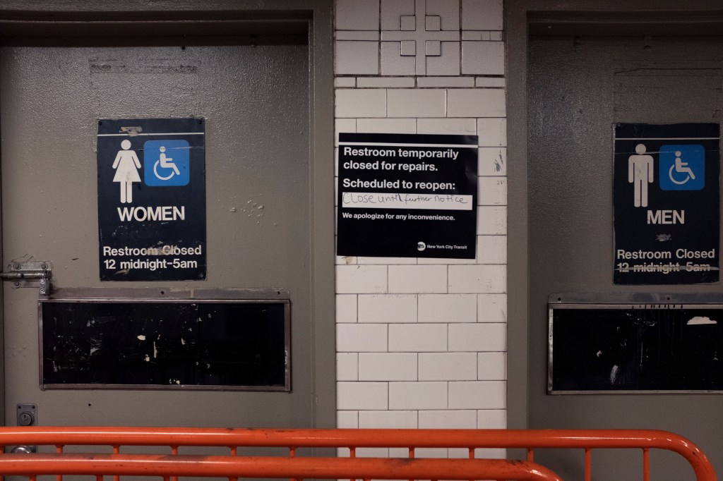
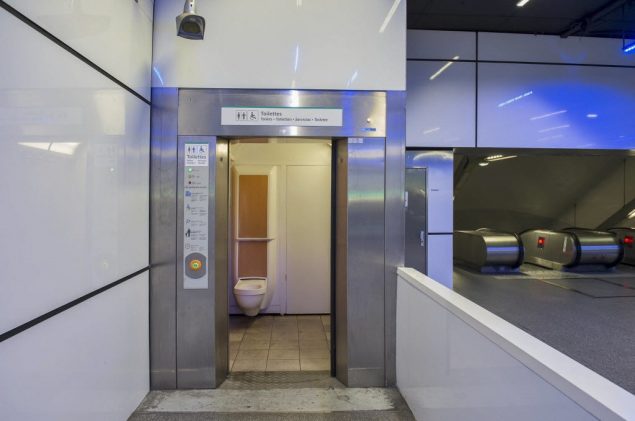
One of the many things made suddenly more obvious by the COVID-19 pandemic was the dire lack of public restrooms in New York City. As shops shut their doors to the public to curb the spread of the virus, it quickly became harder than ever to find any open bathrooms in the largest city in the United States. Further exacerbating this situation was the fact that, shortly after the start of the pandemic in New York City, the remaining public restrooms in subway stations were closed.
It was not always this difficult to find a bathroom in New York City. There were once hundreds of public restrooms scattered across the city’s 472 subway stations, though only several dozen remain. For years, the subway’s remaining public restrooms have been held at arms-length, both by the MTA—which provides little information about where they can be found—and by much of the riding public, few of whom use subway restrooms, but may hear of their existence through occasional articles on their dilapidated condition.
Right now is the time to reopen the bathrooms in the subway system—not just from the temporary pandemic closure, but as an intentional and permanent provision of good public restrooms to New Yorkers. New York’s would be far from the first subway system in the world to incorporate public restrooms for its riders. As with many other much-needed improvements to operations, governance, and rider experience, it is important that we look to peer subway systems and cities to inform the re-opening of restrooms in the subway system, and plan for a future New York where the closest public restroom is always just a few minutes away.
Formerly-public restroom at the DeKalb Avenue L station (you can just about make out the painted-over mosaic reading “women” to the right of the door).Another closed restroom at Astor Place: this had been converted into a newsstand, which was recently closed.
Subway Restrooms During COVID
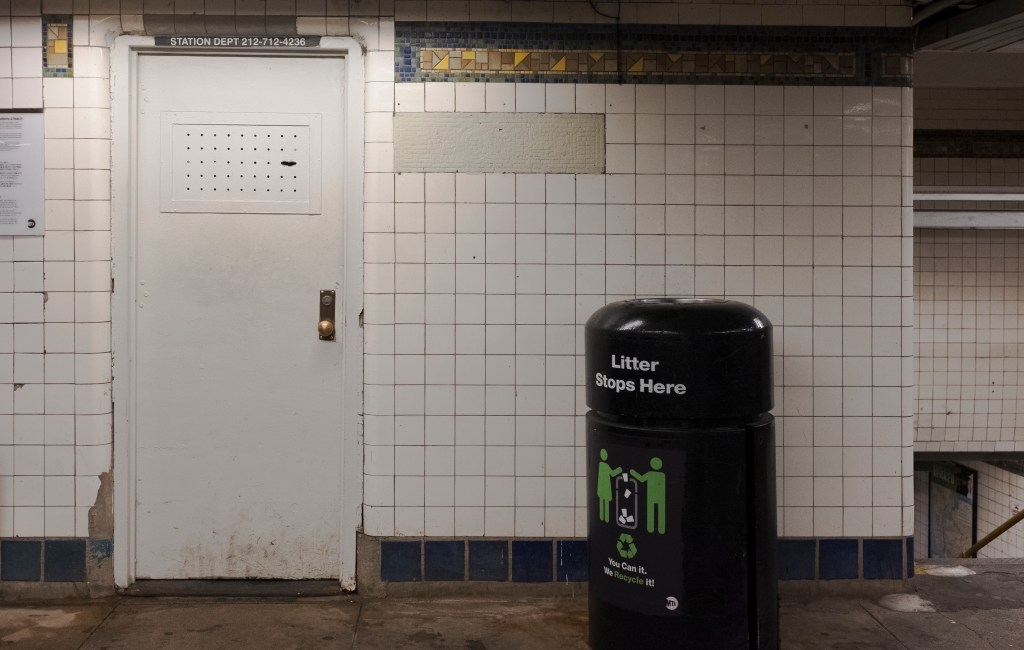
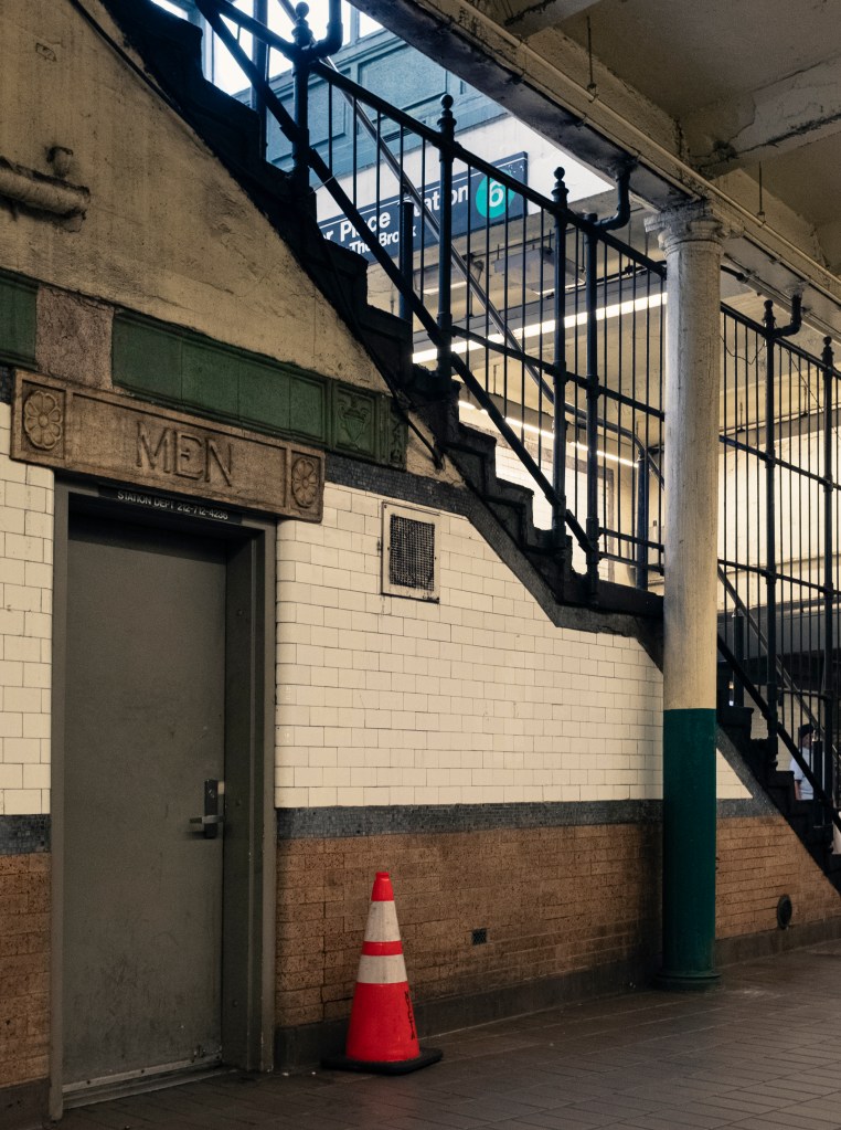
Even if they have been closed to the public for decades, subway restrooms are usually pretty easy to spot in stations, once you know what to look for: typically paired, identical doors, often immediately on the platform-side of fare control. Many retain their original mosaics or plaques, above or next to the doors, such as this example from Astor Place on the Lexington Avenue Line (above). The still-active bathrooms are not advertised ostentatiously, marked only by pretty small, standard-issue MTA signage. Those closed to the public may still serve a purpose: some remain restrooms, open only to staff; some are used as storage rooms; and some have been transformed entirely, like the former women’s restroom at Astor Place, which was recently a newsstand.
Active (but temporarily closed) public restrooms at 14th Street-Union Square.
As the COVID-19 pandemic took hold over New York City in March 2020, subway restrooms were closed as a way of mitigating the spread of the virus. They have all remained closed since; despite increasing calls for their re-opening, the MTA has been non-committal on when they may be unlocked. In a growing trend of political hostility towards homeless New Yorkers, and heightened fears over crime and safety in the subway system, there is a worrying possibility that the agency may be hoping to silently keep bathrooms in the subway closed indefinitely. That would be wrong. New York City, like many US cities, already has a dearth of easily-accessible, truly public restrooms. The subway system—a public space where New Yorkers spend a considerable amount of time, and which already has the required infrastructure—is the ideal place to begin developing a robust network of public restrooms in New York.
Public Restrooms In NYC: A Brief History
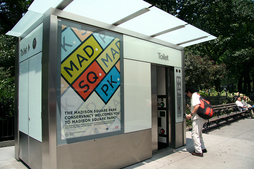
Public restrooms were an important element of New York public works projects in the era of the New Deal, which provided funding for the construction and renovation of public restrooms. During the 1970s and ’80s, many public facilities, including restrooms, were closed, as a result of municipal near-bankruptcy and fears of crime. Since then, there has been no concerted effort to build the city’s public restrooms back to their New Deal-era peak. The most recent effort—the Automated Public Toilet (APT) scheme launched by the Bloomberg administration—stalled several years ago. Only five of the twenty units built were installed as of 2018, and the remainder continue to sit in storage. The de Blasio administration has shown little interest in expanding access to public restrooms in the city, but did very briefly provide portable restrooms during the early months of the COVID pandemic. There have also been one-off projects by Business Improvement Districts to build public restrooms, such as the very highly-rated facilities in Greeley Square and Bryant Park.
Parks Department Comfort Station in Fort Greene Park, Brooklyn, 1936 (image credit)2010s Automatic Public Toilet in Madison Square Park. Only a few of these have been installed in the city despite larger plans. (image credit)
The Rise & Fall Of Subway Restrooms
Former men’s restroom at Astor Place, part of the original, 1904-built IRT subway. Though closed to the public, this remains a restroom for staff.
The history of restrooms in the subway system follows a similar trajectory. The New York City Subway, constructed primarily between the 1900s and 1930s, was built with hundreds of public restrooms across its hundreds of stations. 1940 seems to have been the peak of the subway bathroom, with 1,676 working toilets in the system (and, according to a report, only 12 “unclean” ones). By 1970, as years of poor maintenance had caught up with subway infrastructure, their conditions were deteriorating seriously: “dirt, corrosion and uncollected garbage greet each traveler as he enters the stations. Flaking paint from ceilings and missing wall tiles complete the picture. Conditions in restrooms are equally bad, with many having inoperative fixtures.” In 1982, the Transit Authority locked the vast majority—75 percent—of subway restrooms to the public. Citing decreasing use, vandalism, and problems with safety, the agency reduced the number of public subway restrooms from 788 to 204, the remaining restrooms mainly located at terminals, major interchanges, and other busy stations. Many restrooms remained open for transit staff only.
Since then, there have been only sporadic attempts to revitalize subway restrooms. In 1994, the MTA ran a pilot program at three busy stations—Grand Central, 34th St–Herald Square, and Jamaica Center—to improve the cleanliness and safety of subway restrooms. Staff monitored restrooms every 15 minutes, cleaning and maintaining facilities as necessary. At the time, the pilot cost $287,000—about half a million 2021 dollars—for nine months. “If successful,” the program would have been extended, but this seems to be one of the many pilot programs lost to history.
The improvement of subway restrooms became the subject of agency discussion more recently. The 2017 Fast Forward Plan included a commitment to “improve restroom availability and servicing.” The agency documented progress towards these goals in reports from mid-2018 (on the “overhaul” of restrooms at two stations) and late 2019 (on the reopening of a restroom at the 5th Avenue–53rd Street station and cleaning and repairs at several other station restrooms); this brings us to shortly before the arrival of COVID-19 in New York City, and the resulting closure of all public restrooms in the subway. Fast Forward plan was put on hold last year because of COVID-19’s impact on transit finances, and significant changes in agency leadership since the drafting of Fast Forward throw into question the degree to which the plan will guide the agency’s post-pandemic strategy. The last the public heard about the re-opening of subway restrooms was at the MTA’s June 2021 board meeting. Then-NYC Transit Authority President Sarah Feinberg stated that restrooms should be reopened, but was non-committal about when that would happen, saying only that long-standing issues such as homelessness on the subway should be addressed first.
Public Restrooms On Other Metro Systems
There is something of an age divide that determines whether a metro system was built with public restrooms. Older systems—such as those of New York, Chicago, and Boston—were built with them (Chicago, similarly to New York, closed theirs in the 1970s). Later-20th-century metro systems seem less likely to be built with public restrooms, or were built with fewer of them. (There are, of course, exceptions: public restrooms were built into San Francisco’s BART stations, though many have since been closed, and all 622 of Seoul’s Metro stations have public restrooms).
This later aversion to public restrooms is exemplified in Mexico City where, in 1973, the director of their then-new Metro highlighted its lack of public restrooms as one of the many things that set their clean, modern system apart from New York’s increasingly-dilapidated one. Montréal’s Metro was opened around the same time—in 1966—and also did not include public restrooms (though there appear to be a small handful, which may have been retrofitted). The Vancouver SkyTrain—opened 1985—includes no public restrooms, and while its operator TransLink has said in the past that they would consider installing restrooms, they have made no concrete plans, and the upcoming Broadway subway extension will not include them.
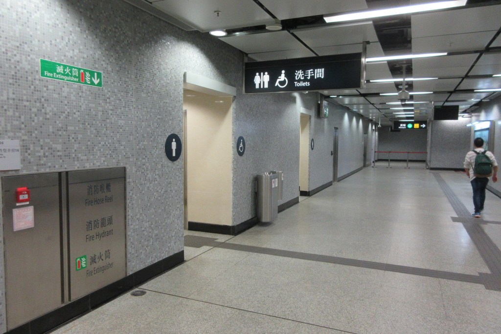
Public restroom at the Ho Man Tin MTR station, Hong Kong. (image credit)
Hong Kong’s metro was opened a decade after those of Mexico City and Montréal, in 1979, and it too did not include public restrooms (though one of the reasons given for this decision was the high availability of public restrooms in the city’s commercial buildings). In 2007, MTR, the corporation which runs Hong Kong’s metro, considered retrofitting public restrooms to their network, but deemed this technically unfeasible as underground stations lacked the requisite sewage capacity and ventilation. However, in 2016, MTR announced a program to retrofit public restrooms to interchange stations by 2020, and appears to have largelyaccomplished this. Restrooms have also been included in all newly-built stations, and MTR has plans to add further restrooms in the coming years.
Toronto’s subway has public restrooms, though only at interchange stations and terminals (and former terminals). In 2012—six years before his Fast Forward plan at the MTA would recommend similar steps—then-TTC President Andy Byford led an upgrade of the system’s restrooms. As well as the replacement of restroom fixtures, the TTC program increased frequency of cleaning from every 4.5 hours to every 90 minutes, and the frequency of “major” cleaning from weekly to five times per week. Availability of public restrooms is depicted on Toronto’s subway map. And though London’s transport network also lacks comprehensive public restroom coverage—they are mainly concentrated at outer-city, rather than central, stations—Transport for London does provide a very convenient Toilet Tube Map.
Paris’s Self-Cleaning Solution
Metro systems around the world illustrate that public restrooms work—but, crucially, they should be well-equipped and well-maintained. New York’s, prior to the pandemic closure, were not. In 2019, a station supervisor (cited in the article linked) said that restrooms at the Norwood–205th Street station) were cleaned three times per day. In both the MTA’s—and other agencies’, such as the TTC’s—past attempts to improve public restrooms, one of the key objectives was increasing the frequency of cleaning and maintenance. This sounds ideal, and it is, but the big downside would be cost: very frequent inspections of restrooms will cost a lot. The specific frequency may depend on the level of use of the station, and in some cases this maintenance may be incorporated into existing cleaning jobs, but increased restroom maintenance will almost certainly be an additional cost for transit agencies.
Public restroom on Paris’s RER line A (image credit)
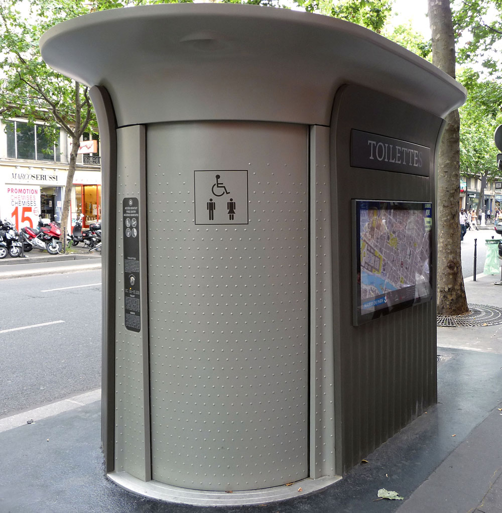
A partial solution to high maintenance and cleaning costs could be to opt for automatically-cleaning restrooms. While New York’s brief experiment with these facilities on the street never gained momentum, such facilities—sanisettes—are extremely common on the streets of Paris, and the technology is also employed in public restrooms on the Métro and RER. According to the RATP–SNCF-run RER A Blog, these restrooms are inspected and cleaned twice per day, even at the busiest stations such as La Défense and Châtelet (presumably, the self-cleaning functions adequately take care of more frequent cleaning).
Sanisettes For The Subway (And The Problem Of Costs)
In the subway, individual sanisette units could be installed in the existing spaces of either active or closed restrooms, which are plentiful in the system.
But the issue of cost is, as ever, not fully solved. Retrofitting self-cleaning restrooms to subway stations will come at a cost, and given New York’s history of construction costs, this is likely to be high. Street sanisettes in Paris cost about €200k per unit; similar units in Montréal cost CA$340k per unit, and CA$3.1m (CAD) for 12 units; but New York’s cost $500k to install in 2014. These costs include new connections to respective cities’ sewer systems, a cost which may be mitigated in subway installations, where restrooms already have sewer, and electrical, hookups. (That said, these savings could easily be negated by the required demolition of existing restrooms).
Maintaining the restrooms does not come without cost, either. Maintenance of Paris’s sanisettes—which takes place thrice-weekly at each unit—is handled by JCDecaux under contract from the city; for 420 sanisettes, the city apparently pays €6m per year, or approximately €14k per year per facility.* But New York’s APTs cost over twice that amount to maintain, at $40k per year in 2014. At Parisian costs, installing one sanisette-style unit at the 76 stations currently equipped with public restrooms would cost $18m, and $1.3m per year in maintenance. But at New York APT costs, this rises steeply to $38m for installation and $3m for maintenance—and that is before we get to expanding the number of restroom-equipped stations, which we should be doing. (In comparison, the MTA’s 1990s frequent maintenance pilot cost about $670k per year for six stations. The frequency of cleaning could probably be lower, but for just the 76 existing restrooms, the yearly cost would exceed Paris’s sanisette prices).
These costs may seem high, but capital costs for better subway restrooms are not escapable. An alternative to automated units could be could be keeping and reopening subway restrooms basically as-they-are, but should be refurbished, which will come with capital costs, and would require higher yearly costs stemming from more frequent cleaning. Realistically, though, it is unlikely that the MTA would finance such a program at either Parisian or New York costs right now—and, at this nadir in city-state cooperation, especially on transit—equally unlikely that the city government would chip in.
* (As of April 2020, the city was seeking a new holder for the contract, as well as the replacement of the facilities by 2024, so this may change).
Conclusion
The MTA should adopt a subway restroom improvement program, either installing new, self-contained units in existing spaces, undertaking refurbishments of existing restrooms, or a combination of the two, based on expected use at given stations. Restrooms should be more clearly signed in stations, and availability of restrooms should be added to the subway map (or otherwise listed in one location) as in London and Toronto. The case for readily-available public restrooms as part of city infrastructure has been made many times, and applies here. This is far beyond a matter of convenience—access to public restrooms is necessary for genuinely accessible public spaces, including transit systems. Given that these will be an important part of the city’s public infrastructure, it would make sense for the city to have a financial stake in such a program—but this will require a different political world here.
Finally, facilities should be free. Hesitancy to provide public restrooms, or desires to place restrictions on their use, is commonly a product of hostile attitudes towards homelessness—thinking which should not be entertained. Paris made its originally-paid-access sanisettes free in 2006, specifically to allow easier access to homeless Parisians. Secondly, most existing subway restrooms are already located on the “paid” side of fare control—there is no need to apply a second “fare” that will accomplish little but make restrooms less convenient and accessible. Ideally, New York would have street-level, free, APT-style public restrooms distributed around the city, outside of the subway, as the sanisettes are—and we should have this. But using the space and infrastructure which already exists in the subway system is the best way of getting public restrooms across the city quickly and efficiently.
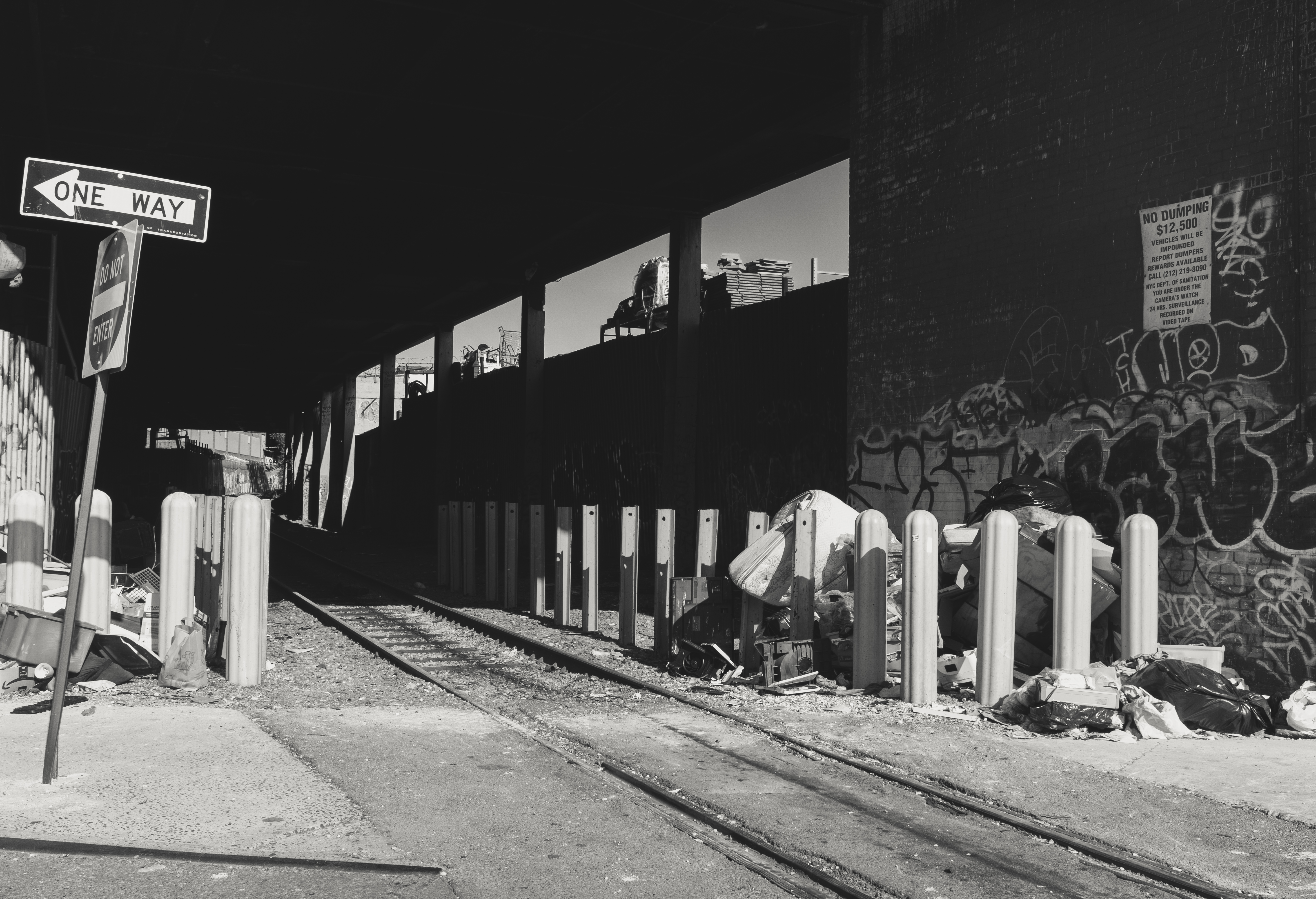
Most New Yorkers probably don’t see freight trains very often. Decades ago, freight rail played a more visible role in the delivery of goods to and from New York City, before mid-century suburbanization and deindustrialization helped bring about the disuse of much of the city’s freight rail infrastructure (and, as a result, gave us the High Line).
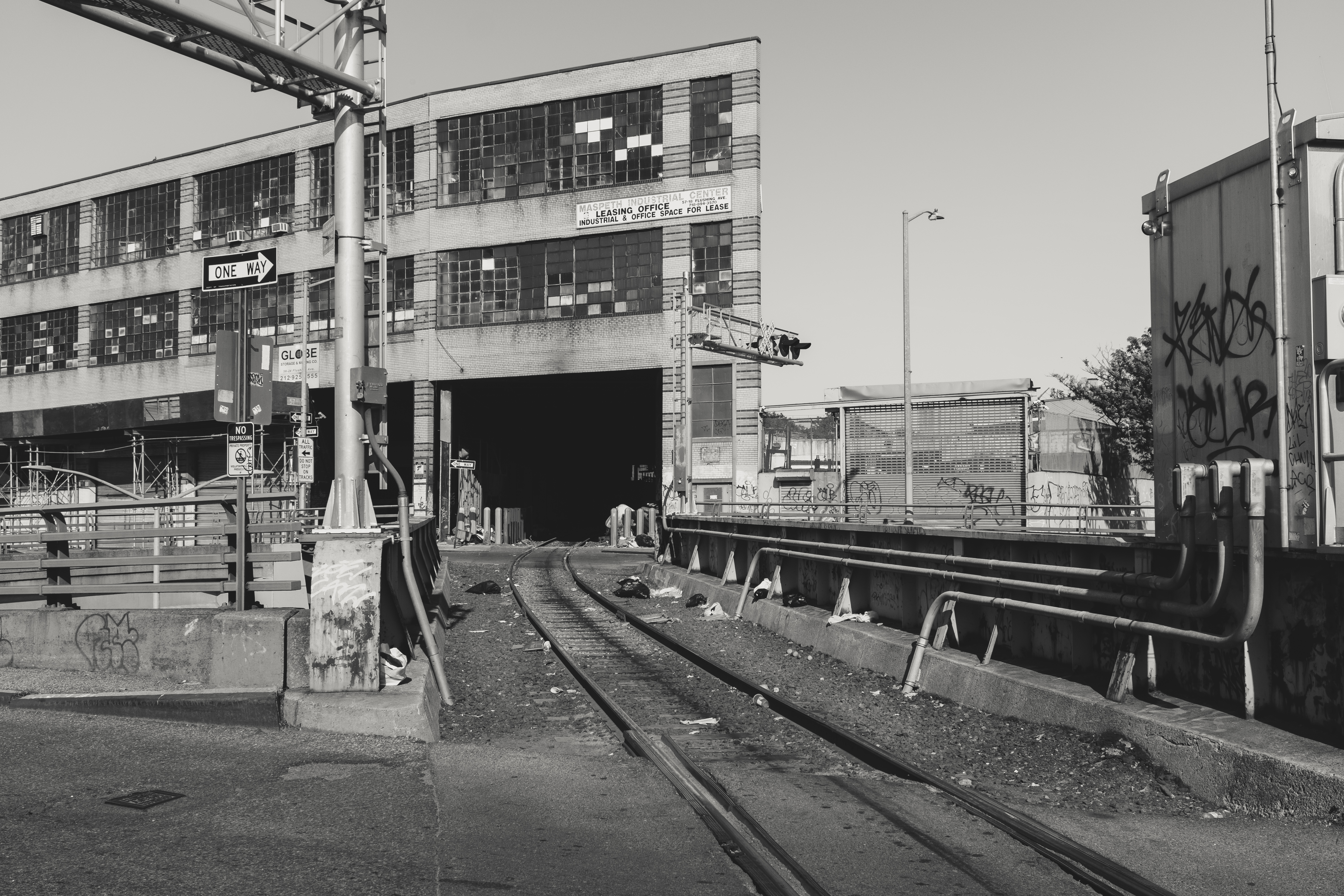
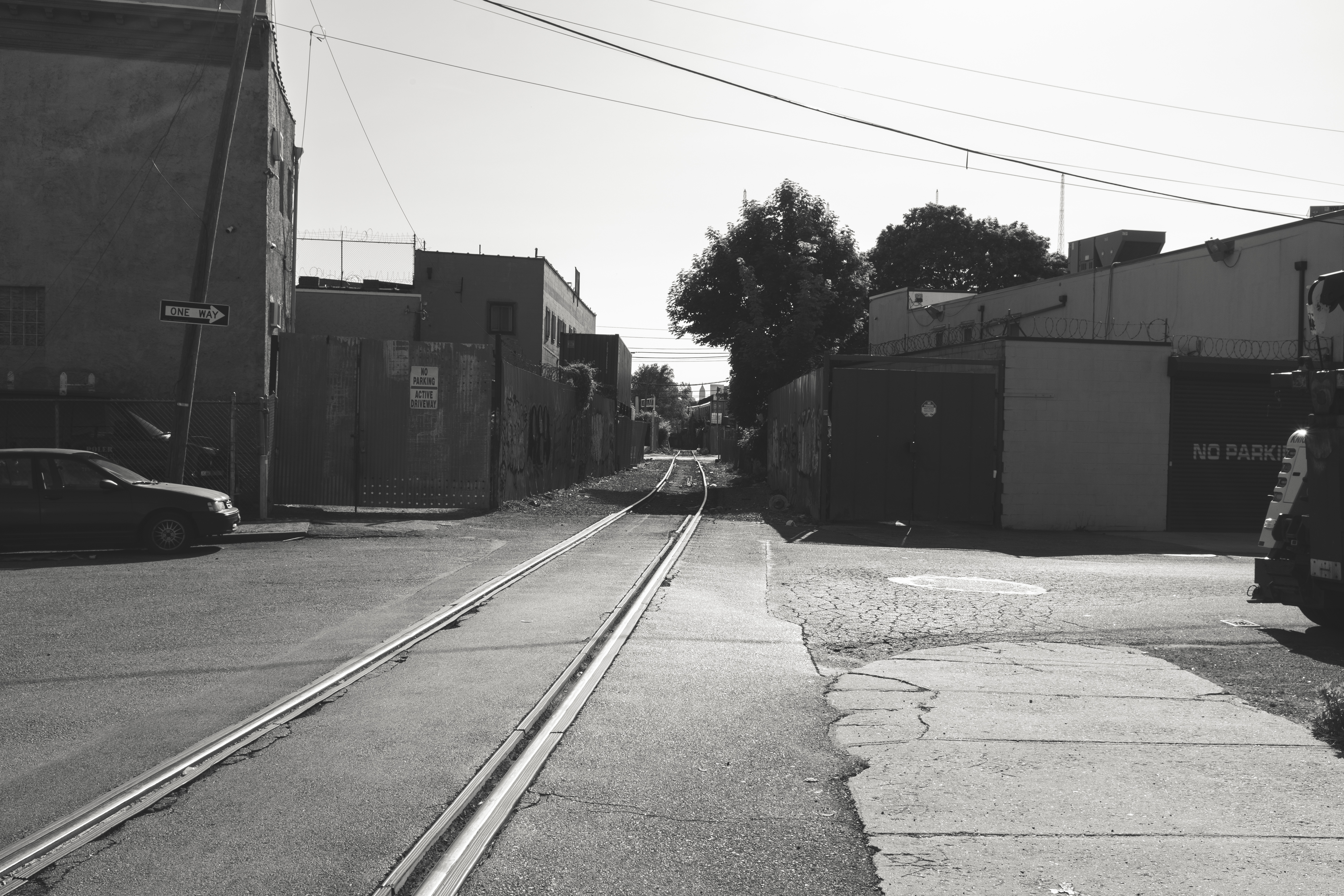
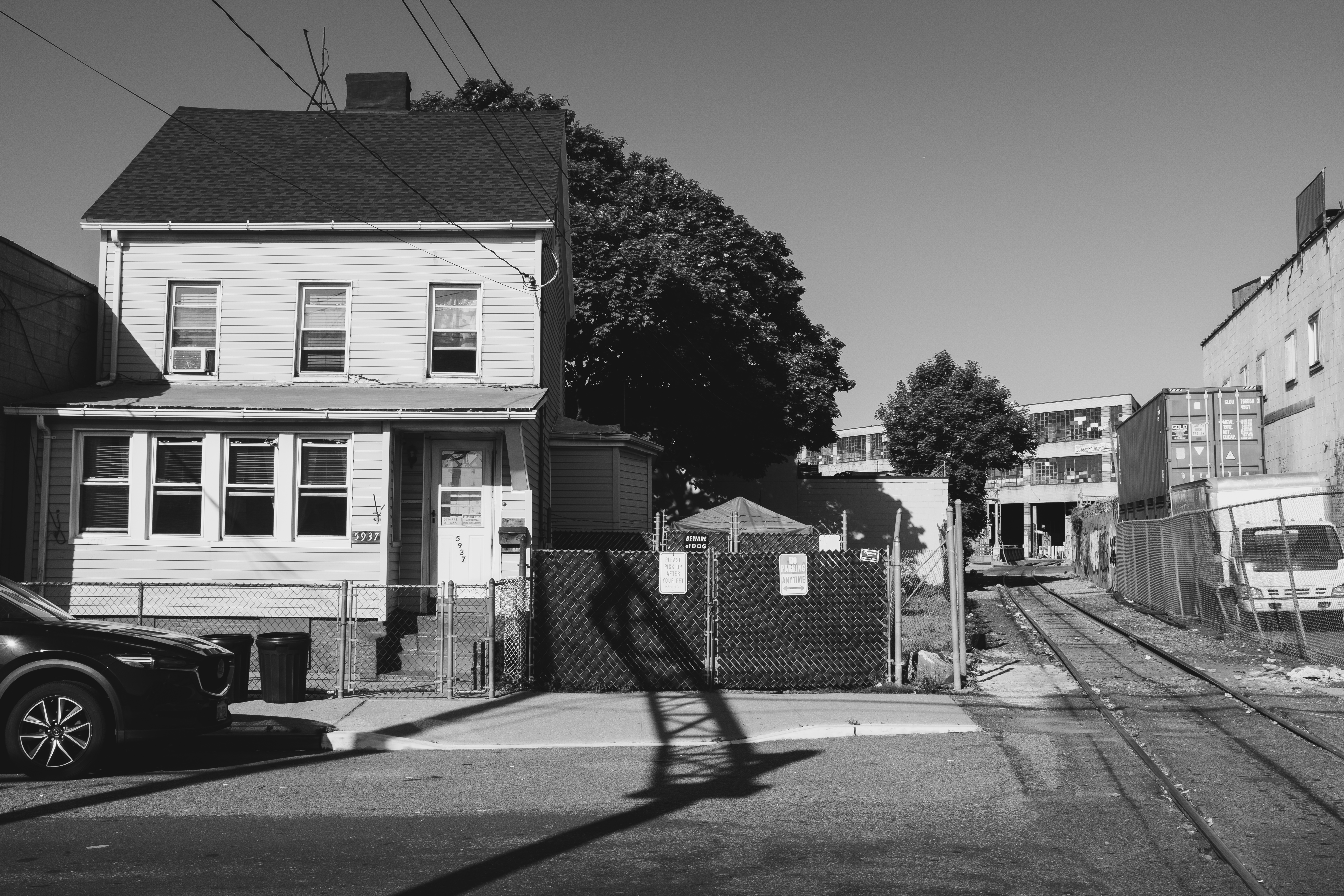
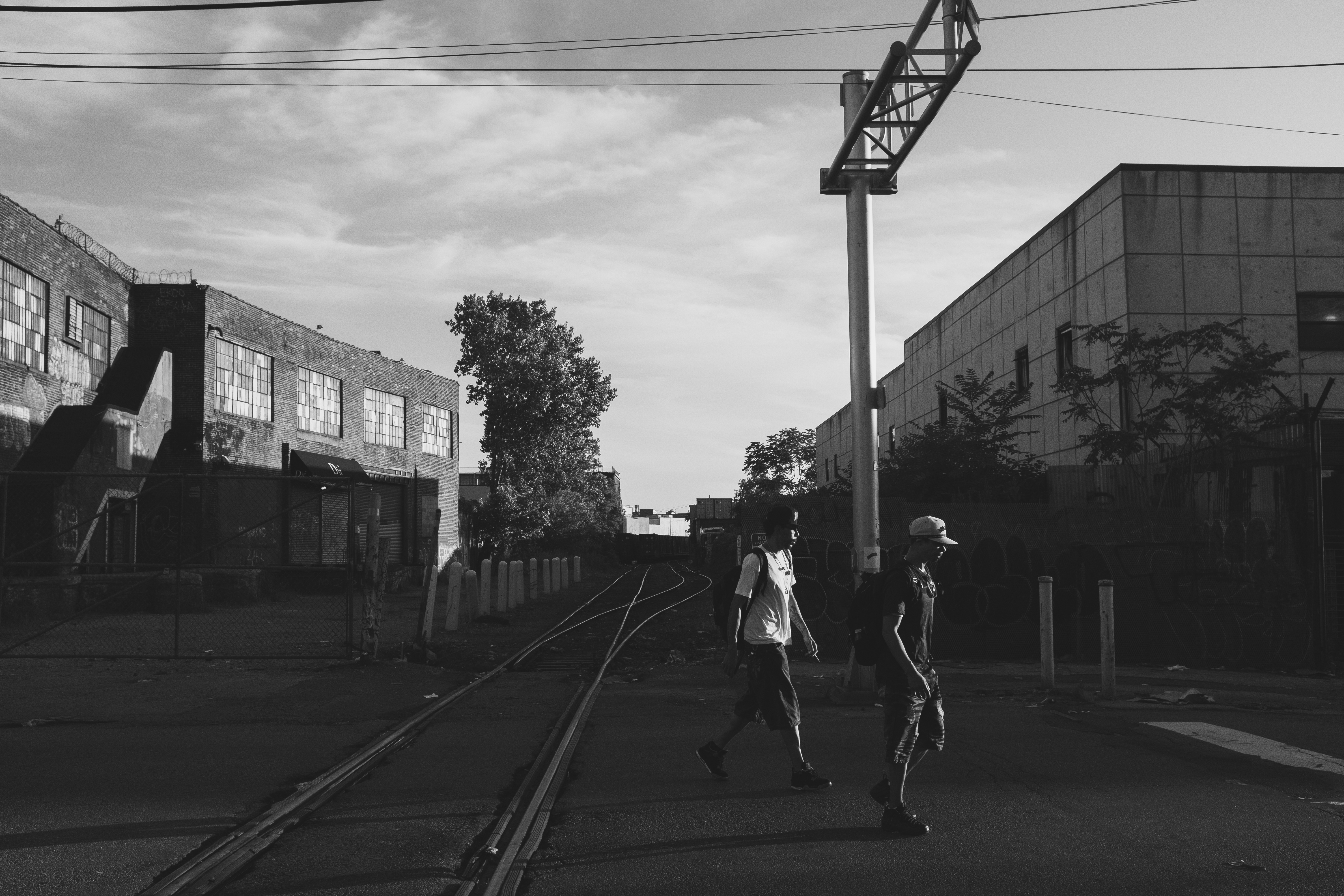
The Bushwick Branch is a spur of the Long Island Railroad’s Lower Montauk Branch, and runs from its junction with the latter line in Maspeth, through Ridgewood and its namesake neighborhood of Bushwick, to its terminus in East Williamsburg. The branch carries freight only, and is symbolic of the era when rail was dominant. Though trains are infrequent today, there remains lots of evidence that it was once a much more important artery to the city.
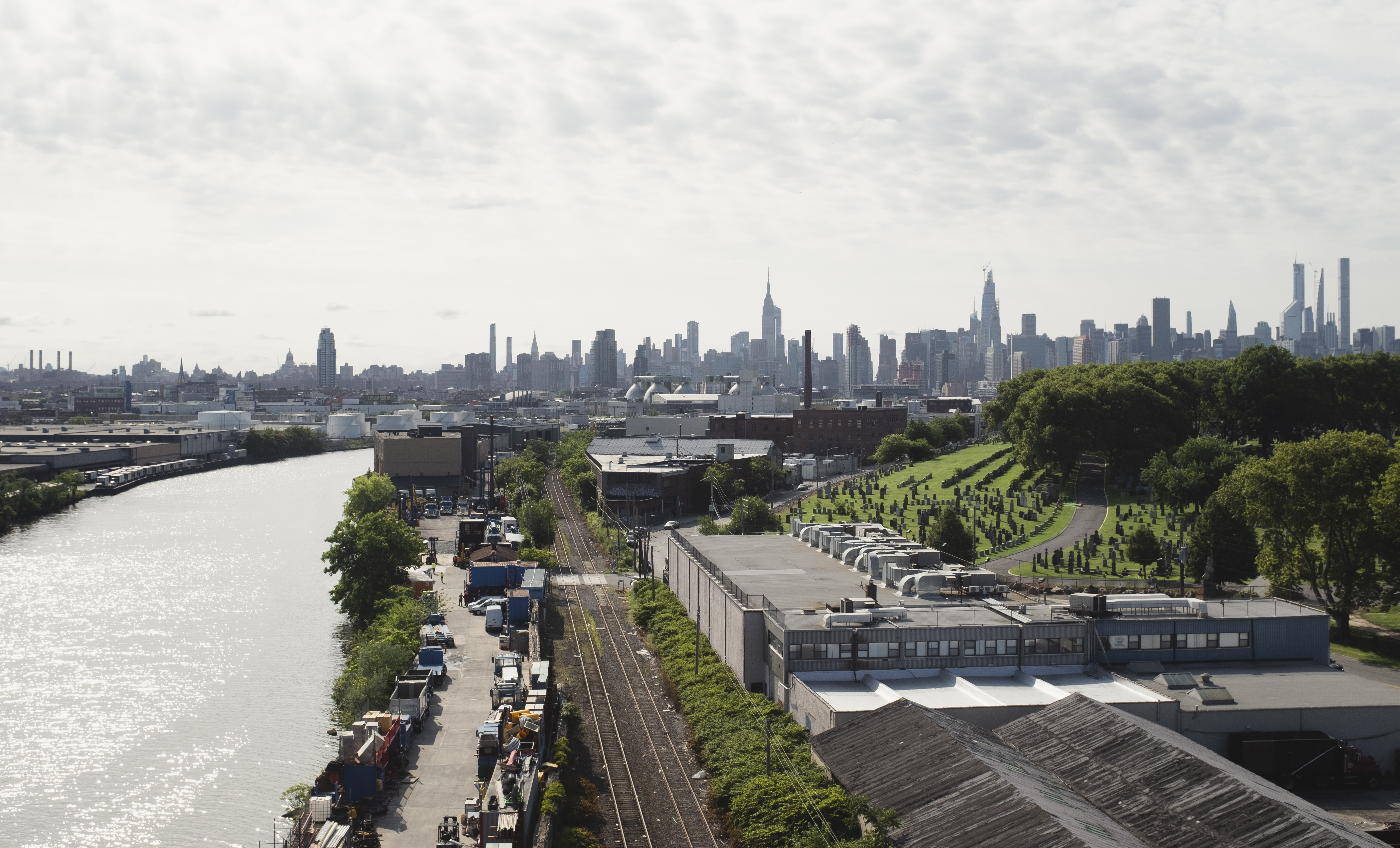
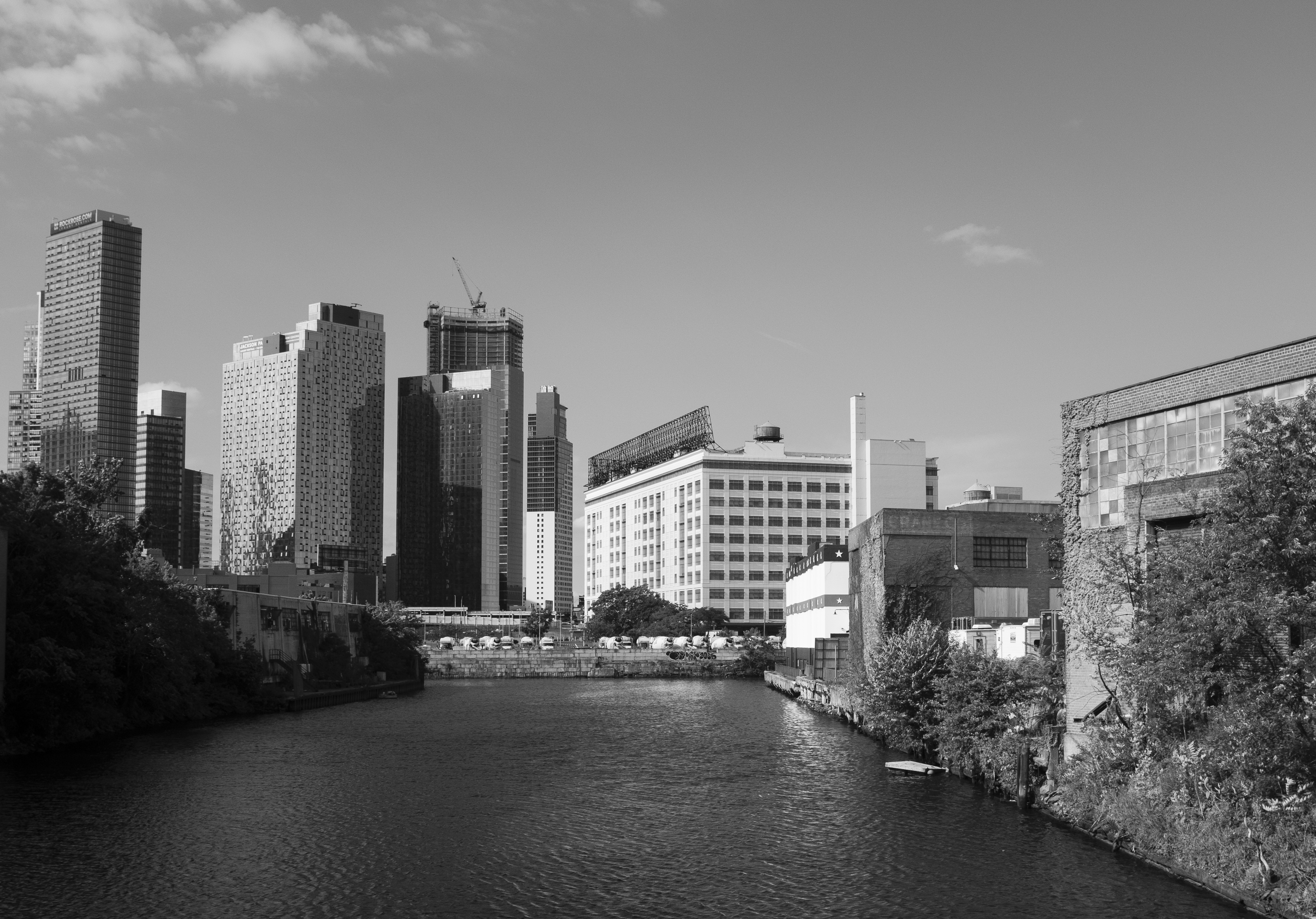
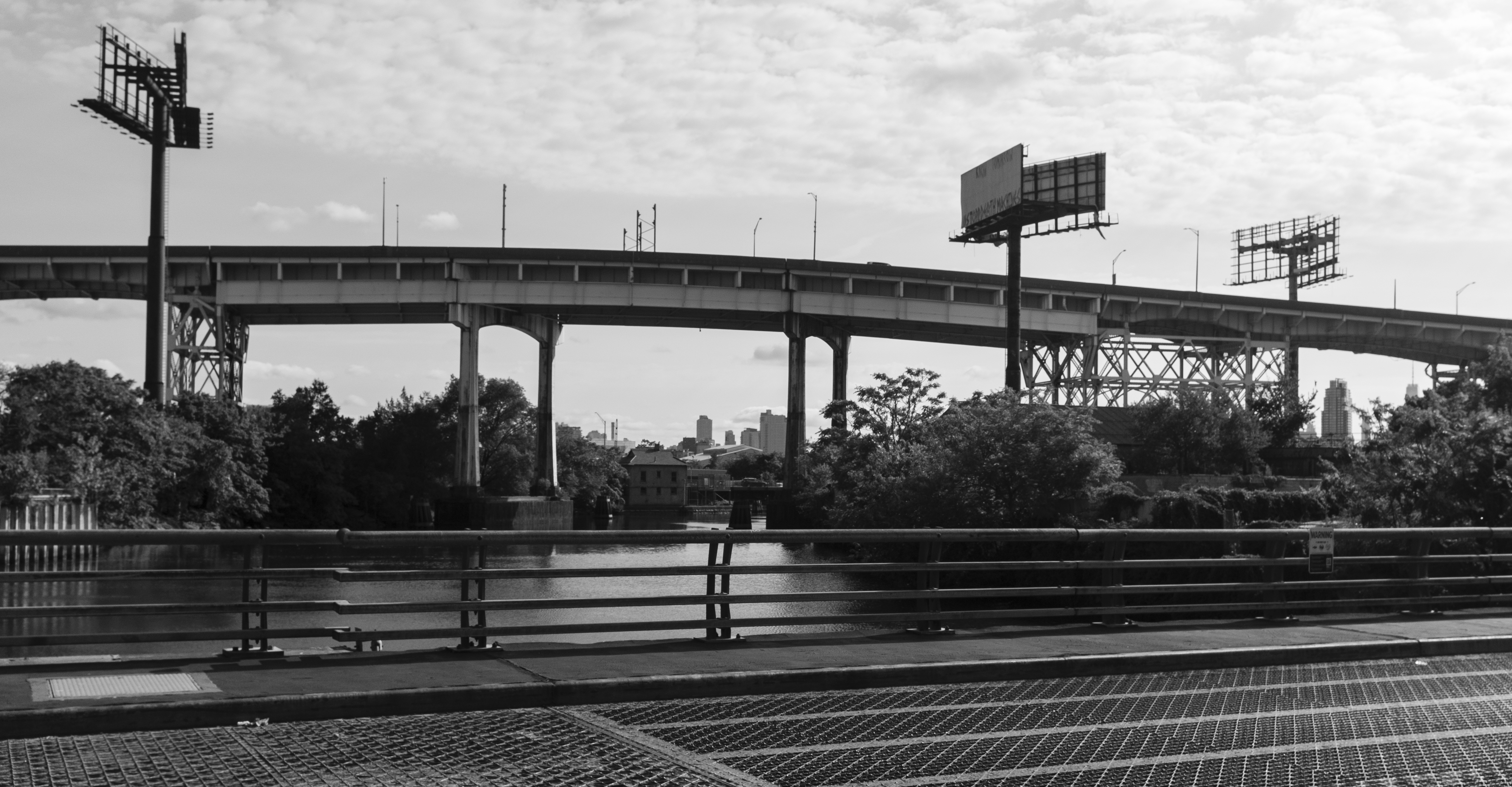
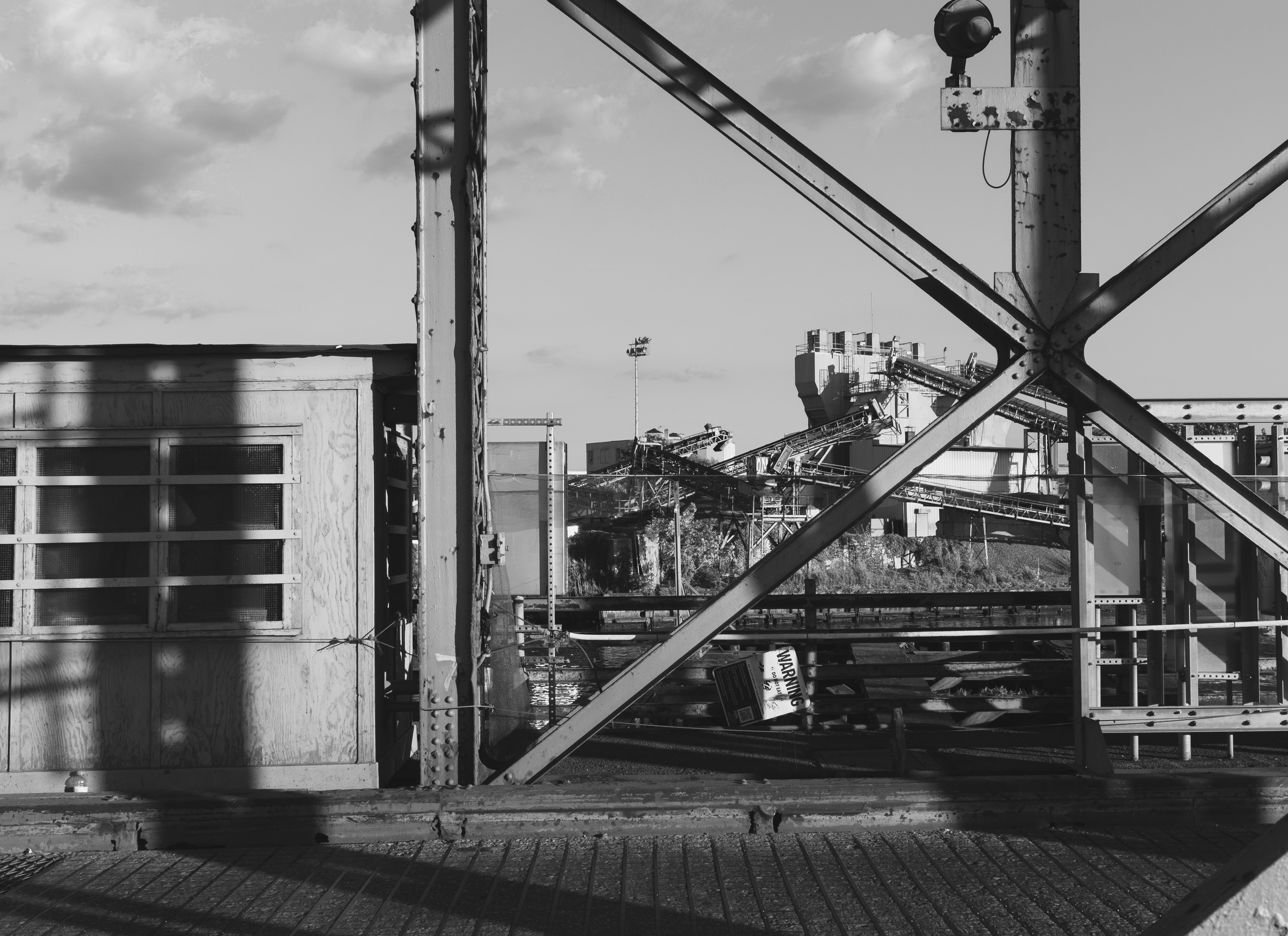
View towards Manhattan from the Kosciuszko Bridge. The railroad tracks in the right photo are the Long Island Rail Road’s Lower Montauk Branch, into which the Bushwick Branch merges further west. Views of Dutch Kills from the Borden Avenue Bridge.The 120-year-old swing bridge over the Newtown Creek at Grand Street, on the border of Maspeth (Queens) and East Williamsburg (Brooklyn).
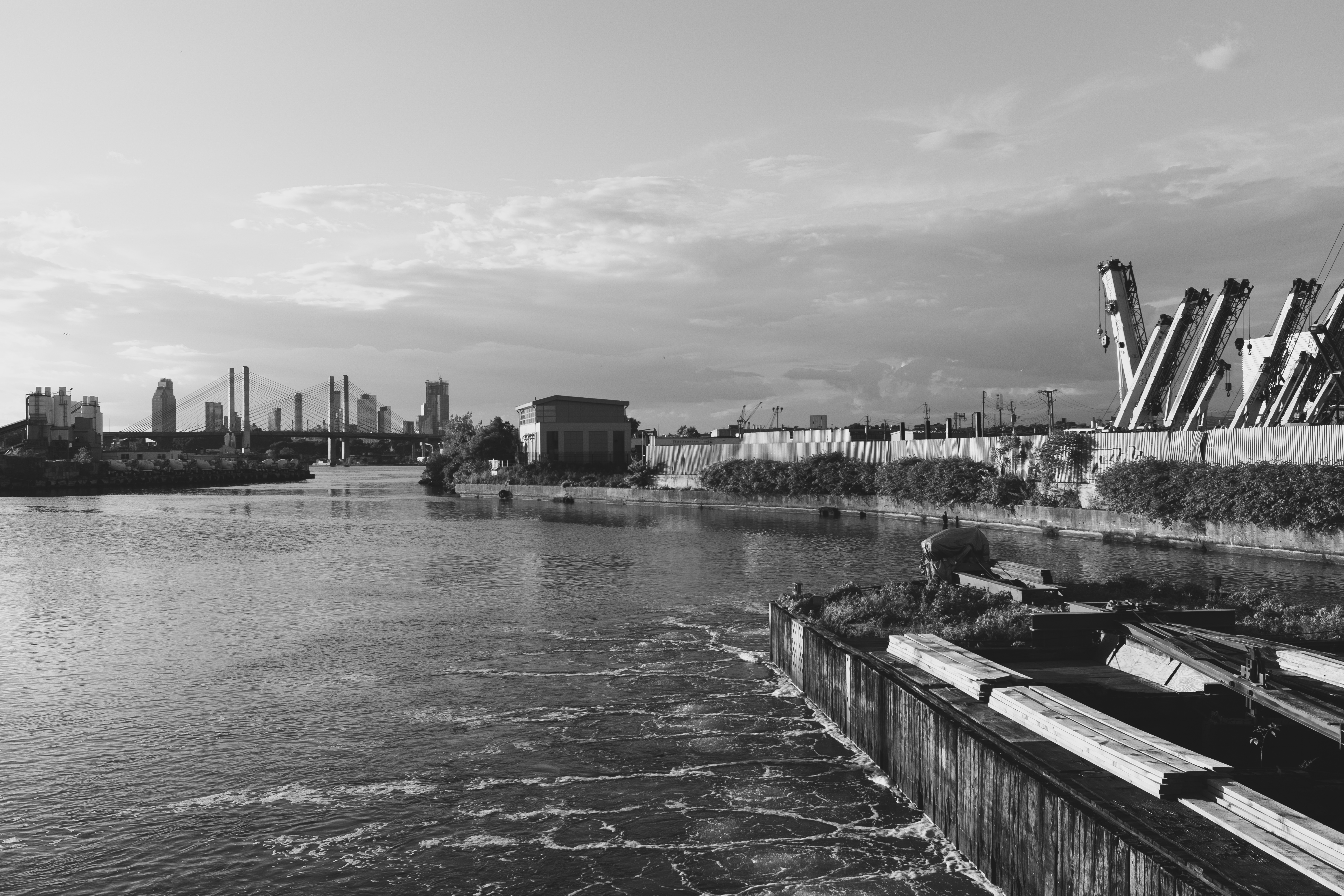
The Newtown Creek is one of the city’s most storied waterways. Once at the center of New York’s industrial economy—carrying more goods than the Mississippi River in 1912—the history of the creek is also a history of urban environmental crisis. Petroleum was the dominant industry along the creek, and pollutants wiped out all natural life from the creek by 1900. Water quality has also been harmed by the creek being part of NYC’s combined sewer-overflow system, which diverts raw sewage into the creek during heavy rain events that overwhelm the sewer system.
Stretching from the East River in Long Island City to Maspeth and East Williamsburg, the creek and its tributaries (“kills”) are crossed by seven bridges, which range from some of the oldest to some of the most modern in the city. The Kosciusko Bridge—where the top row of photos were captured—opened in 2017 and carries the Brooklyn-Queens Expressway (and also pedestrians and bikes), replacing a prior bridge of the same name. The Grand Street Bridge, dating from 1902 (and subject of the third row of photos), is a swing bridge, but has not been opened since 2012. Narrower than the road it serves and increasingly difficult to maintain, replacing the bridge has been discussed for years (and may finally be happening).
View of the Newtown Creek towards Long Island City—including the Kosciusko Bridge—from the Grand Street Bridge.
More Views Of North Brooklyn Industries
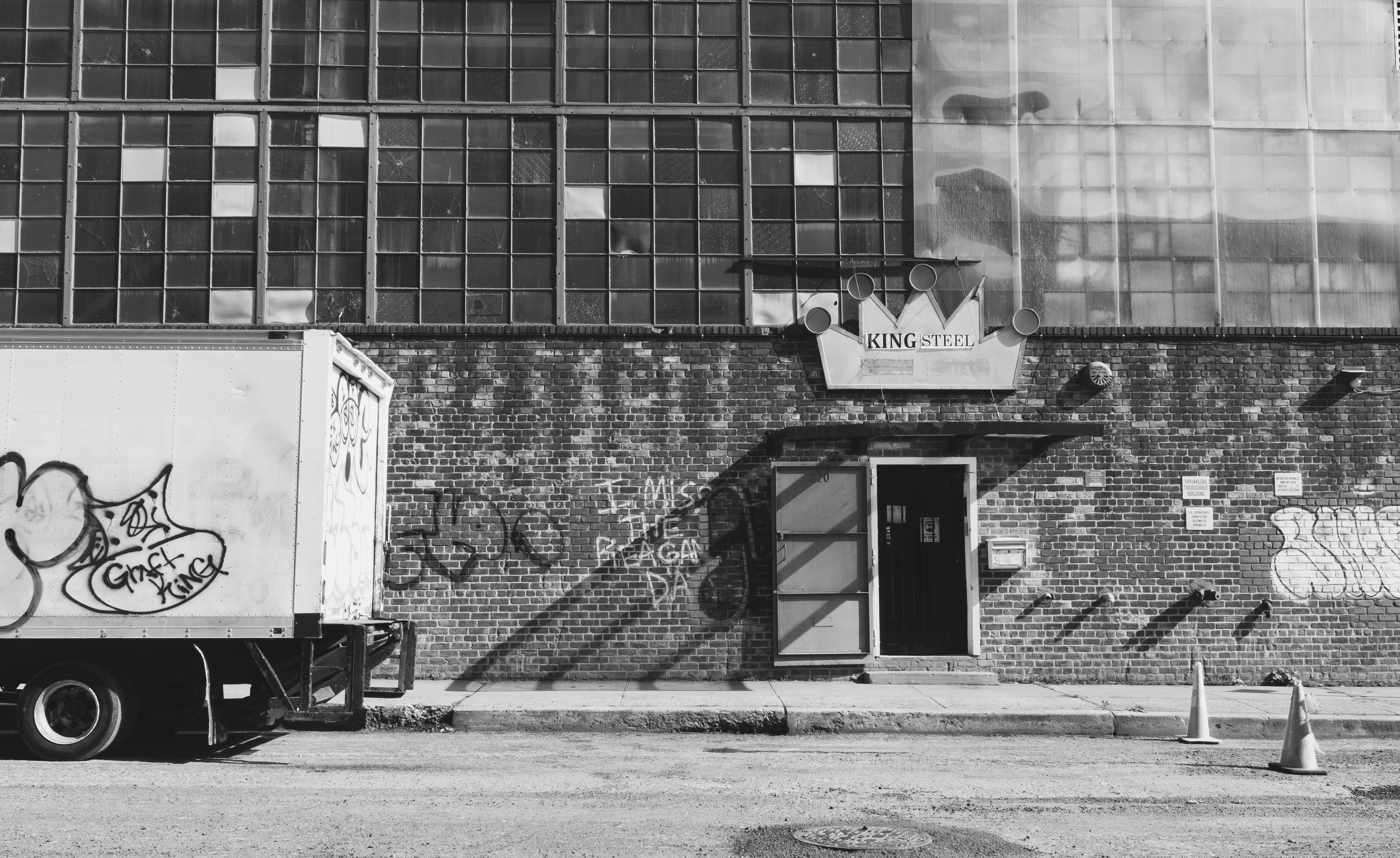
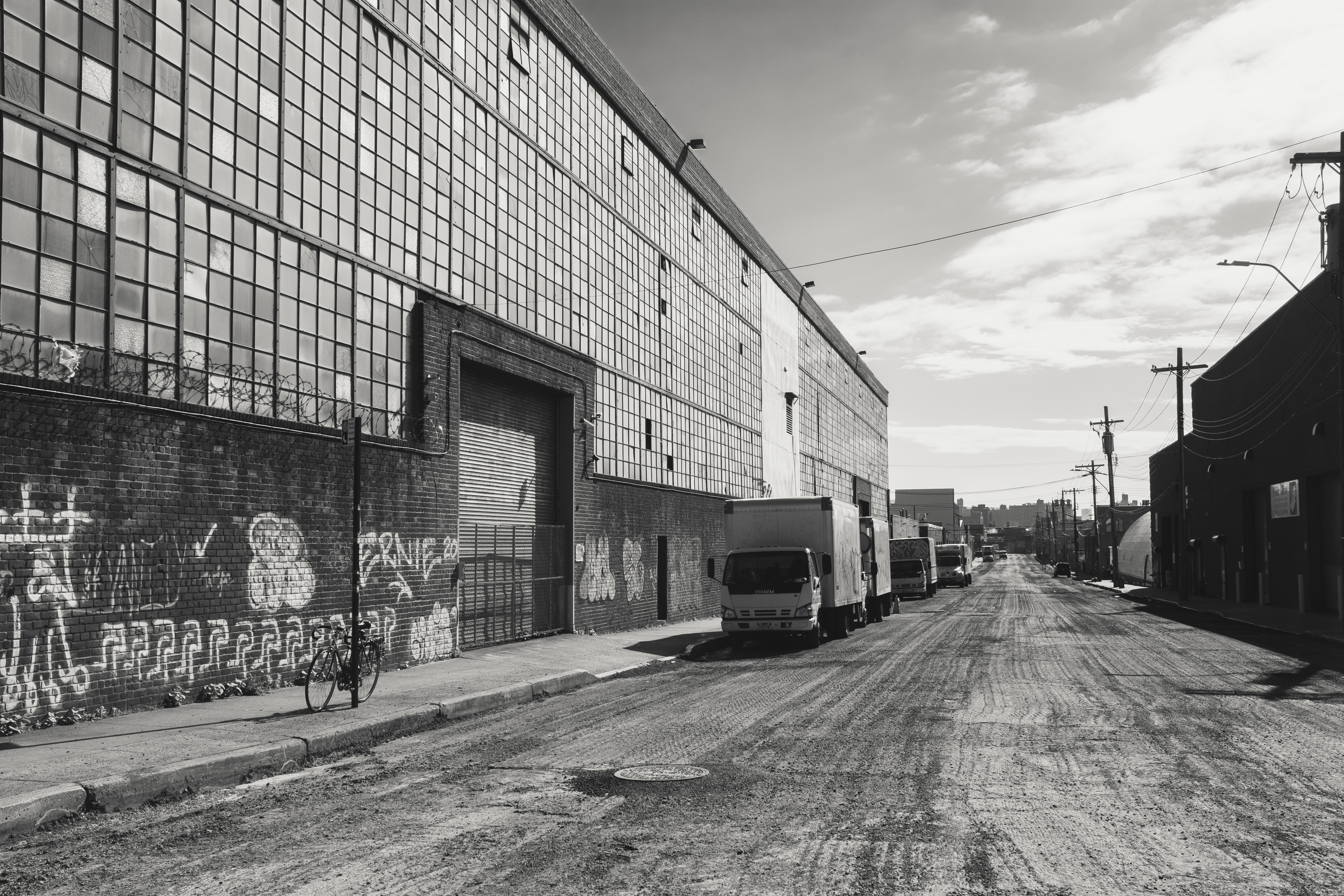
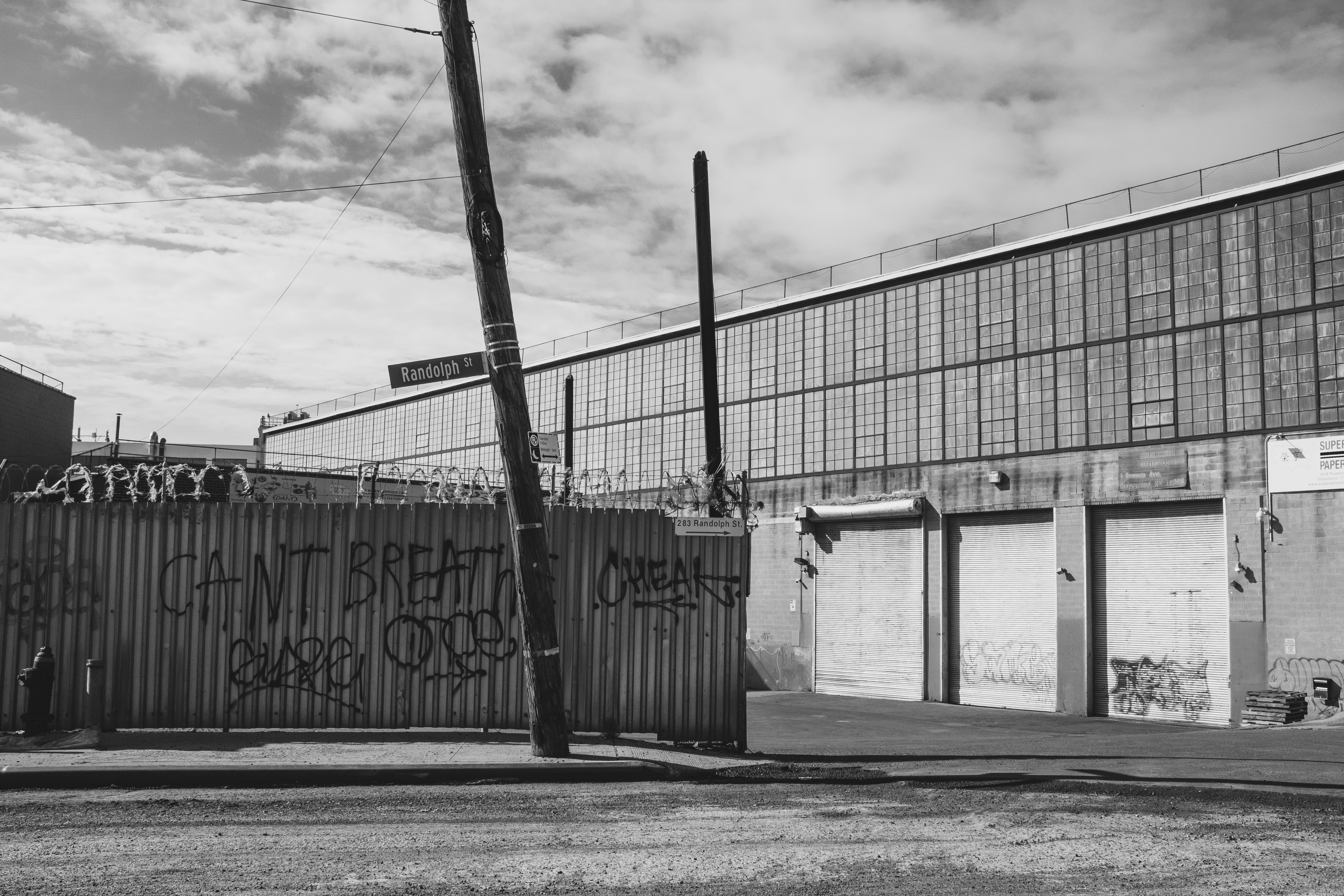
Warehouses along Randolph Street, near the border of Brooklyn and Queens

