Category: Pittsburgh

  • Pittsburgh’s Infrastructure-Saving Open Street

    Pittsburgh’s Infrastructure-Saving Open Street

    Nearly six months ago, Pittsburgh’s Fern Hollow Bridge collapsed into Frick Park. The collapse of the bridge, which severed one of Pittsburgh’s most important traffic arteries, drew the nation’s attention to the sorry state of infrastructure around the country. In the wake of the bridge collapse, the urgency of passing legislation to fund improvements to infrastructure was heightened—not least by the President himself, who had already been due to speak in Pittsburgh on the day of the collapse about the importance of infrastructure investment.

    When the Bipartisan Infrastructure Law championed by President Biden was passed in November 2021, many breathed a sigh of relief: America’s infrastructure was finally going to be fixed. But this relief, unfortunately, is shortsighted. Our infrastructure problem, particularly regarding automobile infrastructure like highways and road bridges, goes beyond just long maintenance backlogs. The problem is not just that we have too much dilapidated automobile infrastructure. The problem is that we have too much dilapidated infrastructure because we simply have too much car infrastructure.

    The Fern Hollow Bridge: A Casualty Of Urban Decline

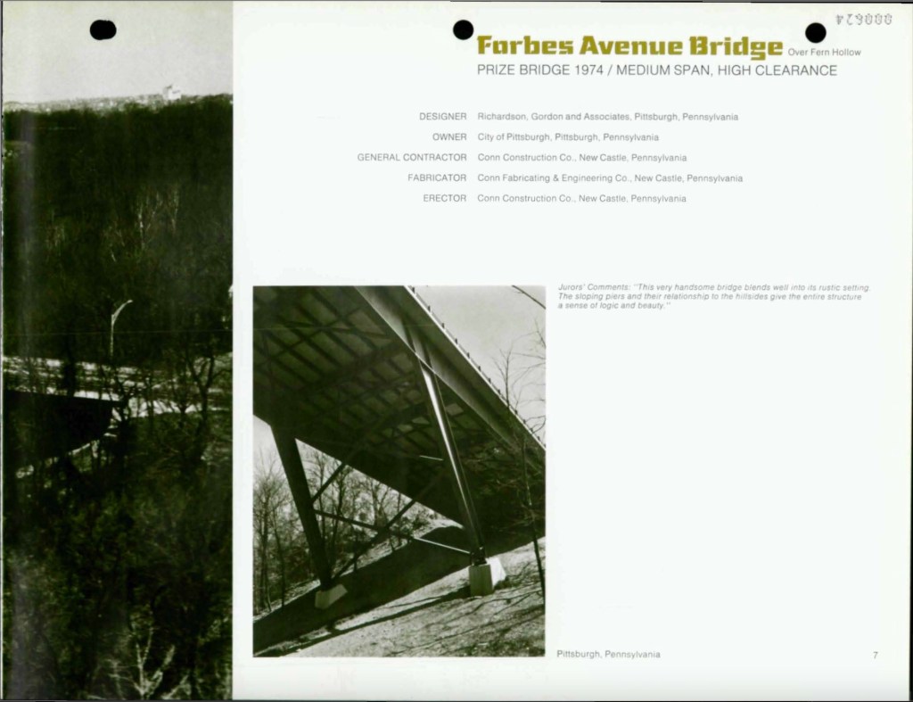
    That Pittsburgh was the location of such a high-profile failure of public infrastructure was particularly salient. Pittsburgh is famous for its hundreds of bridges, carrying roads and rails across the region’s steep valleys and ravines. Pittsburgh is also symbolic of the urban decline that has imperiled so much of the nation’s infrastructure. The Fern Hollow Bridge opened in 1973, replacing an older bridge at the same location dating from 1901. The year after its completion, it was named a Prize Bridge by the American Society of Civil Engineers. On a small level, it is symbolic of the optimistic attempts at modernizing the city that were underway in the 1970s. But this decade was the beginning of an incredibly challenging period for the city and region. During the 1970s, the region’s population was in the beginning of a precipitous decline from which it has yet to recover. The 1970 Census was the first one which recorded Allegheny County’s population as lower than the previous Census, and no subsequent Census would record any population growth in the county until the most recent, in 2020.

    Glowing praise for the then-new Fern Hollow Bridge from the American Society of Civil Engineers in 1974. (From full booklet here).

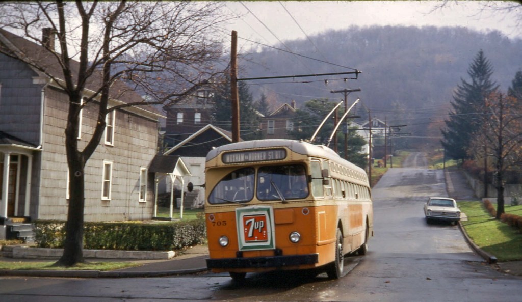
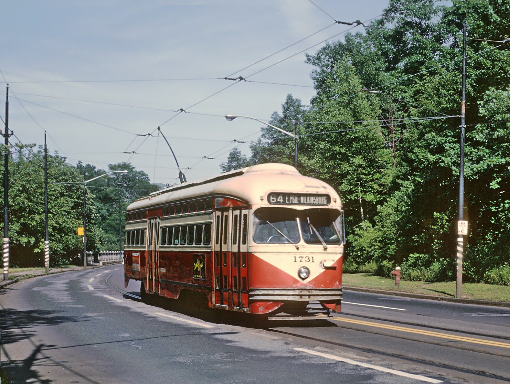
    The original Fern Hollow Bridge stood from 1901 to 1971 and carried automobiles and streetcars, such as this #67 streetcar exiting the bridge in 1967. (Photo credit: Roger Puta, link)

    For the city of Pittsburgh itself, the period of decline had begun before the 1970s. Having already lost 10 percent of its peak population between 1950 and 1960, the city lost another 13 percent between 1960 and 1970, and a staggering 18 percent between 1970 and 1980. Today, the city remains just under half (302,971 recorded in 2020) of its peak population (676,806 recorded in 1950). Pittsburgh’s population decline hasn’t even stopped yet, though it has hopefully been stemmed. (The population loss between 2010 and 2020 was a minimal—perhaps encouraging—0.9 percent). Thanks to suburbanization, Allegheny County has lost a smaller, but still sizable, share of its population since 1970, with 22 percent less population today (1.25 million) than it had in 1970 (1.6 million).

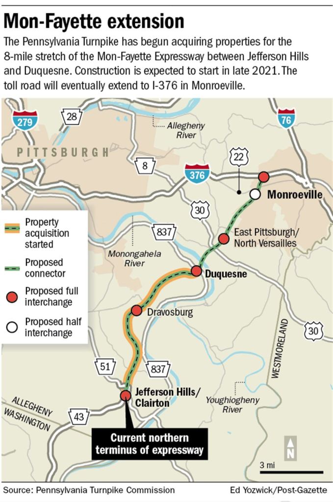
    Despite the loss of population, the amount of automobile infrastructure in the region continued to grow. The Downtown-to-North Hills Parkway North opened in 1989, the loop of Interstate 376 to serve Pittsburgh International Airport opened in 1990, and construction on the final section of the Mon-Fayette Expressway is supposed to begin sometime this year. The upshot of this is that the Pittsburgh region has the automobile infrastructure for a region with a much larger population, and a much larger tax base to fund its maintenance. The Pittsburgh region is far from the only one in America that can claim this story. Across the post-industrial cities and towns of the Northeast and Midwest, there are likely many more miles of roadways and bridges than can be supported by those regions’ current populations. If we want to get the condition of our infrastructure under control, we need to start with infrastructure that is appropriately scaled to the regions they serve today.

    We’re still building new, large-scale automobile infrastructure despite minimal (or no) population growth! This is the soon-to-be under construction extension of the Mon-Fayette Expressway further into Allegheny County. (link).

    I am certainly not the first person to make this point—it was pointed out by several on Twitter (and probably others I missed!) in the immediate wake of the Fern Hollow Bridge collapse. What is important to add here is that Pittsburgh already knows exactly how to transform redundant infrastructure for cars into quality mixed-use spaces for people. Several years before the Fern Hollow Bridge collapse, Pittsburgh successfully converted a roadway facing structural issues into a car-free path through one of the city’s largest parks.

    The Pocusset Street Transformation

    Entrance to the car-free section of Pocusset Street in Squirrel Hill, with modal filter, April 2022.

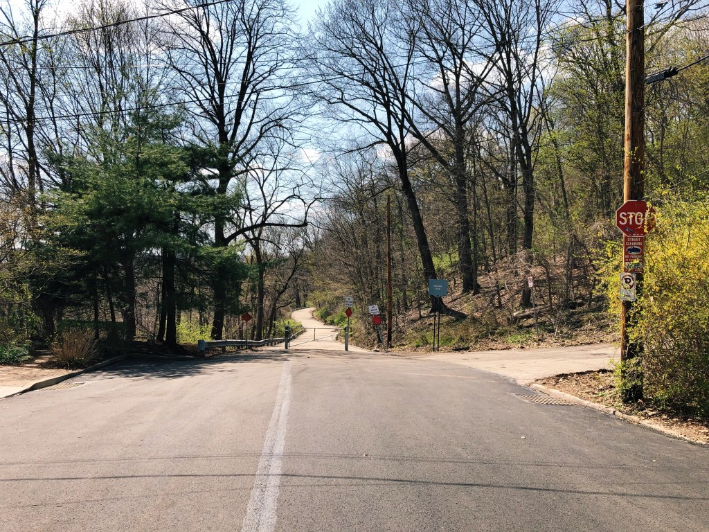
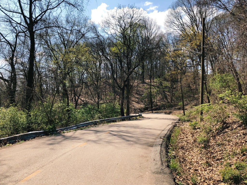
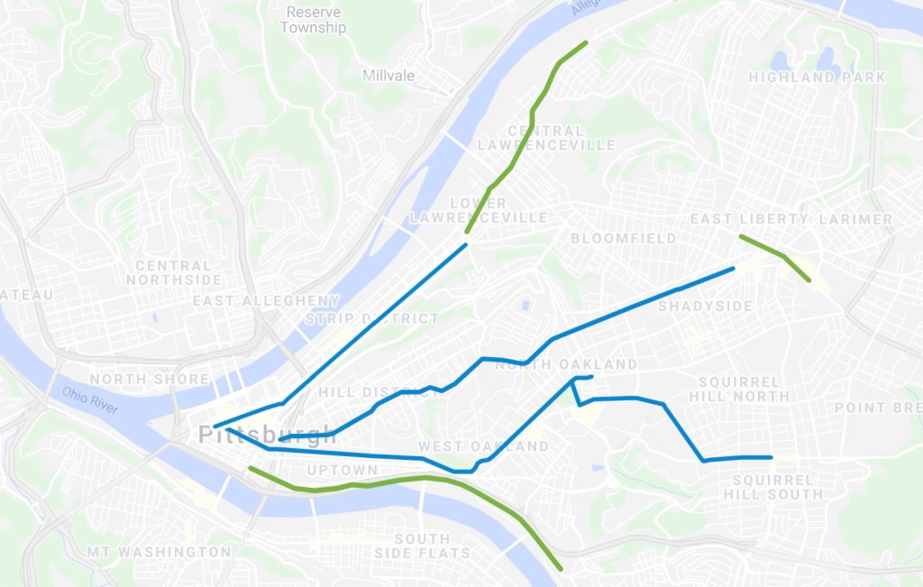
    Pocusset Street is a quiet residential street at the edge of the Four Mile Run valley, which separates the northern and southern sections of Squirrel Hill. Until a few years ago, part of the road also connected Squirrel Hill to Greenfield through Schenley Park, serving as a shortcut for the busier roads through the park. (Local cycling advocacy group BikePGH noted that the road’s narrow width and twisty route through the park made it unsafe for pedestrians and cyclists). In 2012, inspections found that the 0.3-mile section of Pocusset Street in Schenley Park, which carries the road on an embankment high above the valley, was not structurally sound. Storm drains were obstructed, and parts of the embankment were washed out, and one part of the roadway was “undermined by a cavity of between 12 and 15 feet.” The problematic section of Pocusset Street was closed to traffic while the city’s Department of Public Works (DPW) considered rebuild options to allow continued car traffic.

    The necessary rebuilding work was estimated to cost as much as $700,000, money which the DPW did not have. As an alternative, the city floated a plan to reopen the street for pedestrian and bicycle use only, sparing the cost of a full rebuild while opening a new, safe walking and cycling connection between Squirrel Hill, Greenfield, and Schenley Park. The DPW chose to pursue this plan, setting a first-in-Pittsburgh—and possibly the country, according to BikePGH—example of closing part of a street to car traffic and reopening it for people.

    Looking east along Pocusset Street in Schenley Park, April 2022.

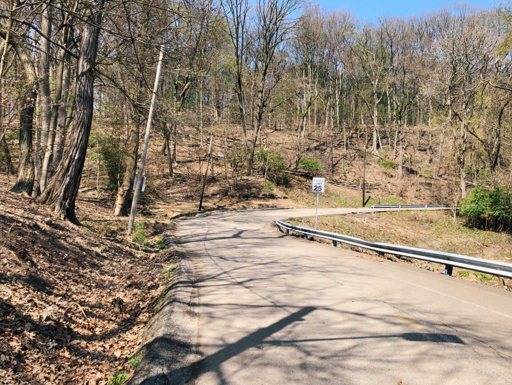
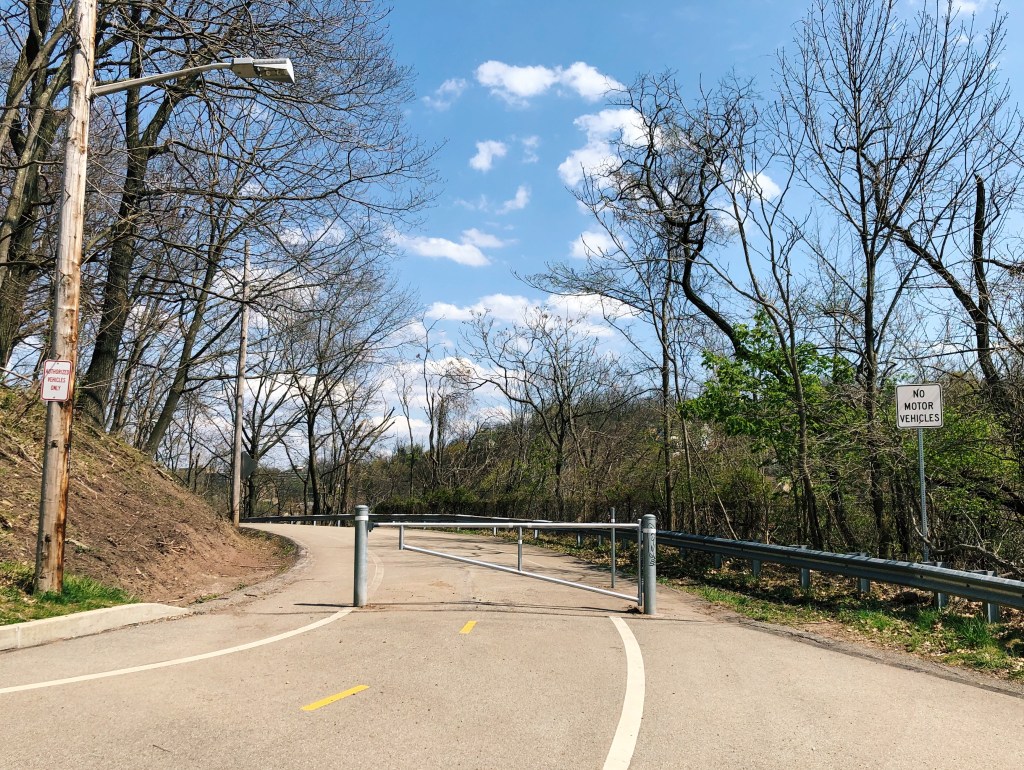
    In 2014, Pocusset Street reopened as a car-free roadway. The city resurfaced the road, installed new lighting, painted new demarcations for pedestrians and cyclists (which have faded quite a lot) and, importantly, installed “modal filters” (the fancy term for barriers) at each end to protect users from vehicles. The nature of the street’s route through the park and relatively-narrow width, both large detriments when it carried car traffic, make it very well-suited and pleasant as a mixed-use path. Its connection to the rest of Schenley Park on one end means that residents of Squirrel Hill can access Schenley Park, and others can travel across it, without walking or cycling on the higher-traffic roads in and out of the park. Walking Pocusset Street today, it is difficult to believe that was a shortcut for car traffic not so long ago—I imagine that future car-free streets, despite how important they may seem to traffic today, would quickly feel the same.

    The Greenfield end of Pocusset Street (the Greenfield Bridge and entrance to Schenley Park on Greenfield Road are immediately behind), April 2022.

    Right-sizing Pittsburgh’s Infrastructure

    In May, Pittsburgh Mayor Ed Gainey announced the beginning of a “bridge asset management program,” to assess of the condition of city-owned bridges and develop a plan for funding crucial repairs. Across Allegheny County, dozens of bridges are already considered by the Pennsylvania Department of Transportation (PennDOT) to be in “poor condition.” On top of those, Pittsburgh and Allegheny County contain many more miles of roadway and lots more supporting structures, like the embankment carrying Pocusset Street, that are also in need of attention. Suffice to say that the Pittsburgh area’s maintenance backlog is long and expensive, and the kinds of infrastructure issues discovered on Pocusset Street—as well as the high cost for their repair—likely foreshadow the issues that will be unearthed by Mayor Gainey’s new initiative. The Department of Mobility and Infrastructure (DOMI), which took over some of the functions of DPW in 2017, has serious issues with short-staffing and administrative capacity according to recent reporting, adding to the already-large challenge of keeping the city’s decaying infrastructure standing.

    Bridges in & around Allegheny County in “poor condition.” State-owned bridges depicted with a circle; local-owned bridges with a square. From Pennsylvania DOT GIS (link).

    The combination of the high cost of infrastructure renewal and the lack of capacity to carry it out leads to the question of whether rebuilding all of the road infrastructure in need of attention to support current—let alone higher—levels of car traffic is a worthy goal at all. The fact that the Pittsburgh region’s automobile infrastructure is oversized relative to its population should be a compelling enough case for the city government to consider whether its responsibilities in maintaining automobile infrastructure can be scaled back. That is before we come to the imperative for all municipal governments to promote a shift away from automobile journeys wherever possible. In its Climate Action Plan, the Pittsburgh Department of City Planning has set the goal of reducing both transportation-related emissions and vehicle miles traveled in Pittsburgh by 50 percent by 2030. This is an ambitious goal that the city should aim to meet, but for this to be possible, the city must make it safer to get around the city without a car. The best, and proven, way to do this is to provide safe, traffic-free routes for those walking, cycling, or using other mobility devices—not expand capacity for car traffic (which, as we know, will encourage an increase in car journeys).

    The car-free transformation of Pocusset Street should serve as a model of how DOMI can use redundant car infrastructure for the benefit of the city. In particular, where sections of road or bridges carry low traffic, have nearby alternatives, or would fit neatly into the planned bike network, the city should convert those to car-free roadways. Doing so across Pittsburgh would be a definitional win-win for the city, which could instead use precious infrastructure funding for more projects—such as improving sidewalks or sewers—and would help Pittsburgh achieve its climate aims. There is every reason to believe that more car-free streets would be popular: events like Pittsburgh OpenStreets prove the demand for more open spaces in the middle of the city, and people should have access to such spaces year-round, instead of for a few days per year.

    That said, a car-free conversion will not be the answer to the Fern Hollow problem. The Fern Hollow Bridge will be (and must be) replaced, though ideally, the new bridge will be friendlier to non-motorists than PennDOT’s current proposal. But as the city takes stock of the full extent of its infrastructure problems, it should take the opportunity to stop holding on to a built environment intended for the last century—it should instead reimagine Pittsburgh’s infrastructure so it is built for the city of 2022 and beyond.

    More car-free streets like this would be an asset to Pittsburgh (also from Pocusset Street, April 2022).

  • How Pittsburgh should electrify its buses

    How Pittsburgh should electrify its buses

    Electric buses are coming to Pittsburgh. The Port Authority of Allegheny County (PAAC) introduced a handful of battery-electric buses to service in the past year, and has placed orders for additional electric buses to be used on the forthcoming bus rapid transit service between Downtown and Oakland. Around the country, transit agencies are ordering electric buses, and subsidies for electric buses may become significant to federal transportation policy. With all the recent buzz around electric buses, you could be forgiven for thinking electric buses are new technology—but they’ve actually been around for decades. Different to the battery-powered vehicles in the press today, trolleybuses—electric buses which draw power from overhead wires—were once far more prominent, though only survive in a few US cities (Boston, San Francisco, Seattle, Philadelphia, and Dayton). Returning to the trolleybus—aided by some advancements in battery technology—is the best way to electrify the United States’ bus fleet, and Pittsburgh happens to be a great place to start.

    Quick aside on trolleybus history: Pittsburgh is actually somewhat unique in never having hosted trolleybuses. Many cities used trolleybuses as a sort of transition between streetcars and diesel buses, but Pittsburgh kept its streetcar network relatively late (into the 1960s) and went straight to diesel buses. However, nearby (but much smaller) western Pennsylvania city Johnstown did have a trolleybus network! (Ok, back to the point).

    Trolleybus in Johnstown, PA, 1967.

    Enter In-Motion Charging

    In Europe, cities and bus manufacturers have been combining trolleybus and battery technology, to produce in-motion charging (IMC), described by transit writer and best practices expert Alon Levy in a really good post on their blog Pedestrian Observations (which was the inspiration for this post). As noted here, in-motion charging works best “when relatively small electrification projects can impact a large swath of bus routes. This, in turn, is most useful when one trunk splits into many branches.” Pittsburgh’s extremely radial, trunk-based bus network could be particularly well-suited to trolleybuses which use IMC: putting up wires on a few major corridors could bring pollution-free bus service to much of the city.

    Trolleybuses For Pittsburgh

    The most important variable in planning an IMC network is the off-wire range of the vehicles. Longer-range IMC buses on the road right now include Kiepe Electric’s buses in Solingen, Germany, with an off-wire range of 18 km (11 mi). Kiepe is supplying the electrical equipment for Dayton’s new trolleybuses, which have an off-wire range of 24 km (15 mi), according to Dayton’s Regional Transit Authority. For the purposes of this, the hypothetical Pittsburgh IMC bus has an off-wire range of 20 km, which seems optimistic against most IMC systems in operation (which average between 5-15 km off-wire), but is probably do-able given the range of more recent buses.

    Prospective Pittsburgh trolleybus infrastructure map. Blue indicates first-priority corridors (explained below); green second-priority corridors. Map linked here.

    So where should the city be stringing up trolley wires? Here are the four corridors that I think would be the strongest, and which, together, would bring all-electric bus service to a large swath of the city:

    • Fifth Avenue: Wiring Fifth Avenue between Downtown and Craig Street would be sufficient for the four main Fifth Avenue routes to complete their trips and return off-wire. (The 71A & B take two different routes to Highland Park, an approximately 10 km round-trip; the C & D go to Wilkinsburg, just over 14 km). The 71A and 71C could also pick up wires on Centre Avenue (see below) which would further shorten their off-wire segments.
    • Forbes Avenue: The Forbes Avenue routes branch further east, in Squirrel Hill, so wires should extend to Murray Avenue (also good because getting up said hill would be a not-insignificant battery drain). The 61D to the Waterfront mall—a 12.4 km round-trip—should be fine, and the 61B might just make it to Braddock and back (18.8 km), but the 61A and (especially) C are >20 km round-trips, so are difficult without opportunity chargers (more on this later) at their outer termini.
    • Liberty Avenue & Butler Street: Wiring the Liberty Avenue spine between Downtown and Lawrenceville, around 33rd Street, would provide enough power easily for the 88 (11 km) and maybe for the 86 (19.6 km, though this could have help along Centre Avenue) and 87 (18 km). You’d have to extend wires along Butler up to about 55th Street to bring the 91 just within round-trip range; this is a bit far, but might be worth it because this section is shared with the circumferential 93 and the 87 (which would bring that route within safe all-electric range).
    • Centre Avenue: Between Downtown and East Liberty, Centre Avenue hosts several bus routes, and contains some significant gradients in the Hill District, which make it ideal as a trolleybus corridor. Wiring Centre Avenue as far as Negley or Euclid would provide sufficient power for the 82, and shorter sections of power for many more routes: the 54, 71A/C, 81, 83, and 86 all have segments on Centre Avenue and, with wires on other sections of their routes, could be made fully-electric.

    With the four corridors above, much of Pittsburgh’s East End would have fully-electric, pollution-free bus service. You may (rightly) point out that this proposed list is very East End-biased—this is really where the trunk/branch structure is strongest. In other areas of the city, the trunks are shorter and the branches longer, less desirable for IMC: this includes Carson Street in the West End and South Side, and North Avenue in the Central Northside.

    There are other corridors that would work. Wiring Second Avenue as far as the Pittsburgh Technology Center could make the 57, 58, and (maybe) 56 fully-electric; Murray Avenue hosts frequent service and is hilly so may be worth it. Short but busy sections of route where buses’ boarding times are long, such as Penn Avenue in East Liberty, can also work for IMC.

    The busways are the most glaring omission above—the reason they were left out above is because they are a real mixed bag of branch lengths, but enough branches could work with opportunity chargers at termini. If these were available, the busways would, of course, be very attractive routes for electrification—there are already several busway branches, such as the P17, P71, and G31, which are within the 20 km off-wire range. The other omission is the South Hills routes: these share a trunk (the Mount Washington Tunnel), but that is already wired for light rail, and trolleybus and light rail wires are not electrically compatible (trolleybuses need a separate return wire, rail vehicles do this through the running rails and therefore do not).

    Opportunity Charging

    Opportunity charging refers to the ability of vehicles to recharge briefly while they sit in one place, either at certain bus stops or at a terminal. The required infrastructure is a short section of wire which buses can connect to while standing, as employed in Solingen, Germany, and being considered in Gdynia, Poland. Placing opportunity chargers at terminals effectively doubles the off-wire distance that vehicles can travel, as they would only need enough battery power to make it to the terminal, rather than to the terminal and back to the wires. Opportunity chargers would allow, for example, the 61A & B to run to their terminals in Braddock (11.8 and 9.4km from Squirrel Hill, respectively), and the 61C to its terminal in McKeesport (15.9km). This would also open up several East Busway branches—including the P67 (a 9.7 km branch), P7 (14.7 km), and P68 (19.7 km)—to IMC operation, as well as the remaining West Busway branches, the G3 (16.9 km), and (maybe) the 28X (22.2 km).

    IMC opportunity charging “station” in Solingen

    Why We Should Want Trolleybuses

    Surely—you may be thinking—battery-powered buses could do this just as easily? And if they can’t now, at the rate technology progresses, in a few years’ time they might—so won’t all these wires will have been wasteful? Nope! There are several key, fundamental advantages of trolleybuses over batteries.

    IMC buses recharge their batteries while in service. This is a major difference with exclusively battery-powered vehicles, which need to stop and recharge with sufficient power to complete their next trip. This can take place at terminals, but only where terminal layovers are long enough to fully recharge; otherwise, battery buses have to be removed from service for some amount of time in order to recharge. The lack of ability for battery buses to recharge in service also means their batteries—a significant portion of the cost of an electric bus—need to be larger than those of an IMC vehicle. Battery-only vehicles are also less resilient: the range of battery-electric buses has been shown to suffer in cold weather and on steep hills—two things Pittsburgh is infamous for having in large amounts.

    Most importantly, trolleybuses are extremely well-proven technology. Cities around the world have operated trolleybuses for over a century, and there are numerous long-standing precedents from which Pittsburgh (or any other city) can draw best practices on trolleybus operation. Philadelphia’s pilot of battery-electric buses has come to a halt, while its 98-year-old trolleybus network soldiers on. Dayton has operated trolleybuses since 1933 and, as mentioned above, has recently invested millions in its continued operation. And these are just the two examples nearest to Pittsburgh—looking internationally can provide further guidance on trolleybus operations, especially with the addition of in-motion and opportunity charging.

    Re-Embracing The Trolleybus

    If we want to develop or expand trolleybus and IMC networks, we have to encourage them. Right now, the Federal Transit Authority (FTA) subsidizes purchases of battery-electric (as well as fuel cell and hybrid) buses through its Low or No Emission Vehicle Program. But this program doesn’t cover the infrastructure costs of hanging new trolleybus wires. As “fixed guideway” projects, agencies building new trolleybus wires need to apply for FTA Capital Investment Grants instead, placing them in competition with rail transit projects. This should be changed. The Clean Transit For America Act, which increases funding to the Low or No Emission Vehicle Program, should change the guidelines of the program to include trolleybus/IMC vehicles, as well as the cost of wiring. This is an important policy change not only on the off-chance that a city like Pittsburgh decides to develop a new trolleybus network—but because the strategy for bus electrification in existing trolleybus cities should be extending wires, not scrapping them for batteries, as Boston seems worryingly to be considering.

    PAAC’s first battery-electric buses, courtesy of the Pittsburgh Post-Gazette

    IMC can create a “best of both worlds” electric bus, mitigating the logistical issues with battery-electric buses while keeping their off-wire flexibility—and electrifying a lot of bus service without the cost of wiring every bus route in their entirety. The point of this post was not to say that battery-electric technology is bad; after all, it is advancements in battery tech that allow IMC to work, and which will allow it to improve in the coming years. But electrification of buses is imperative for the climate and for public health. There’s no time to wait for battery technology to advance to the point where it is able to carry an entire city’s bus fleet, at reasonable cost and with acceptable reliability. If we want large-scale bus electrification soon, it is time to re-embrace the trolleybus.

  • Pittsburgh should extend the T

    Pittsburgh should extend the T

    Every city has that transit fantasy: a proposal for transit along a certain corridor, or in a certain neighborhood, which goes back generations, has been the subject of numerous studies and proposals, but has yet to materialize. New York City has the Second Avenue Subway (though a short, first segment of it opened in 2017); Philadelphia, the Roosevelt Boulevard subway; Washington, D.C. has long wished for a Metro station in Georgetown; and San Francisco may one day get around to building a Geary subway. (I could go on).

    In Pittsburgh, the Downtown-to-Oakland corridor has been the subject of successive transit proposals. In the 1910s, the Pittsburgh Plan proposed a traditional heavy rail subway. The ill-fated 1960s plan for Skybus—an automated rubber-tired system—included a line to serve Downtown and Oakland. Thirty years on, a 1990s study considered a “Spine Line,” extending the “T” light rail tunnels which had since been built Downtown, to serve Oakland. As any Pittsburgh transit rider will know well, none of these proposals were ever realized.

    Drawing of proposed Skybus vehicle, www.brooklineconnection.com/history/Facts/Skybus.html

    Bus Rapid Transit: What’s Happening

    Last year, the Port Authority of Allegheny County (PAAC) received a federal grant for Bus Rapid Transit between Downtown and Oakland. This comes at the same time the agency is developing NEXTransit, its 25-year plan for transit in Allegheny County. For the first time in a Pittsburgh-area transit proposal of this scale, there is no plan for grade-separated transit between Downtown and Oakland — the agency has assumed that BRT will accommodate demand for transit in this corridor for at least the next quarter-century.

    Bus Rapid Transit Overall Infrastructure Map (PAAC).

    This is unbelievably shortsighted. Pittsburgh clearly has ambitions of growth as a city as it continues its post-industrial “renaissance.” This growth is happening in Downtown and Oakland (perhaps particularly so in Oakland, which is the home of Pittsburgh’s two largest universities and several major hospitals). Grade-separated transit, like a subway, has a higher capacity than even the best bus rapid transit systems, and can carry far more people with less operational costs than buses.

    None of this is to say there is anything expressly wrong with the BRT plan — it will be positive for transit in Pittsburgh. Despite being the busiest in the region, buses running between Downtown and Oakland today are forced to compete for space with private cars. The improved reliability that will come with dedicated bus lanes will encourage more people out of their cars and on to transit. Even if a subway were to be built here, the bus improvement projects taking place now are still worthwhile—buses from across the city should still converge on Oakland and should do so in dedicated lanes and at accessible, well-designed stops.

    Why A Subway Is The Better Long-Term Choice

    For the purposes of this, “the subway” will be along the lines of the 1993 proposal: a branch of the existing light rail tunnel from Steel Plaza, along (or near) 5th Avenue through Uptown, and along Forbes Avenue through Oakland. The main capacity benefit of a light rail subway compared to bus rapid transit — that light rail vehicles carry more passengers than buses — is obvious. These translate into cost savings for the Port Authority, particularly in operations, which were highlighted in the 1993 Spine Line study. Light rail comes with higher construction costs than bus rapid transit, but gives major savings on operations costs back to the agency. In 1993, PAAC estimated that light rail would cost between 4.3 and 6.6 million dollars less in annual maintenance compared to increased bus service. Free from traffic lights and congestion, fewer light rail vehicles are required to meet the same level of service currently provided by buses (and adding more service can cost less). While BRT can bring about of these benefits by speeding up buses, it’s difficult to compete with the reliability of grade-separated transit. On top of this, light rail services can be composed of 2 or 3 vehicles coupled together and driven by a single operator, transporting numbers of passengers who would otherwise require several buses.

    Light rail alternatives considered as part of the 1993 Spine Line study. The Colwell alternative is most similar to the BRT currently under construction; as we’re only looking at Downtown–Oakland (not onward to CMU or Squirrel Hill), assume a subway line today would end at Schenley Plaza (point 12), where the dedicated BRT lanes will end.

    These benefits will reach far beyond the Downtown–Oakland corridor. This is by far the busiest bus corridor in Pittsburgh, and as such consumes a tremendous amount of PAAC’s resources and vehicle-hours. A light rail line would release buses currently used in Downtown–Oakland service to strengthen service elsewhere. For example, spare buses could boost Pittsburgh’s weak circumferential transit, and promote a broader reorganization of the bus network, focused on connecting neighborhoods and intersecting faster light rail service to Downtown (the network today focuses almost exclusively on Downtown-and-back service). Bus frequency on several other key corridors could increase as well—allowing PAAC to realize some of the regional improvements proposed in NEXTransit—all while the total money spent by PAAC on bus operations remains neutral.

    Beyond the transit planning implications, the real case for the subway is about the growth of Downtown, Oakland, and Pittsburgh as a whole. The 1993 study estimated that there were 29,000 workers in Oakland; by 2018, this had grown to 65,000, according to a report from PAAC, with over 56,000 within a quarter-mile of the BRT project (or a subway along the same route). Oakland is the heart of Pittsburgh’s healthcare and education industries, which are driving the city’s post-industrial economy. As employment in Oakland continues to grow—and there is little to suggest that it won’t—a subway will be able to better adapt to rising ridership (and for the reasons outlined above, will be able to do so with lower operational costs than buses).

    So why isn’t a subway even getting looked at this time? Construction costs are clearly the biggest obstacle (which is exactly what was stated in the 1993 study). It is not a secret that transit construction costs in the United States are incredibly high, particularly for tunneled projects, which this would have to be. To be honest, comparable projects — other light rail tunnels in dense areas of US cities — do not inspire much confidence in Pittsburgh’s ability to construct a Downtown–Oakland tunnel at a bargain price. The two most similar projects — San Francisco’s Central Subway and LA’s Regional Connector — are expensive, at $618.5m per km (SF) and $556.5m per km (LA). These aren’t perfect comparisons, as costs for land in Pittsburgh will be less, and much of the Downtown–Oakland tunnel will not have to contend with an environment as dense as downtown LA or SF. It is fair to assume that the cost per km in Pittsburgh will be less, but not enough less to stop a Downtown–Oakland tunnel, between 4 and 5 km, from quickly approaching $2b in construction costs.

    I suspect the total exclusion of a subway from consideration may also have a lot to do with the political scars of Pittsburgh’s last experience with subway construction. The 2012 North Shore Connector project — which extended the light rail from Downtown, across the Allegheny River, to the North Shore stadiums — fell victim to the cost inflation and timeline overruns that too frequently plague major infrastructure projects. The project was criticized before construction had even begun for having questionable value. Unless you park on the North Shore before heading to your job downtown, or are a regular at Steelers or Pirates games, it is hard to see what the Connector contributed to an improved Pittsburgh transit network. But a Downtown–Oakland line could not be more different! Downtown and Oakland are not just the two largest centers of employment in the city, these are—behind Center City Philadelphia—the second and third largest employment centers in Pennsylvania, respectively.

    We Need Ambitious Transit Projects

    “T” car at a Downtown subway station, https://www.brooklineconnection.com/history/Trolleys

    “Extend the T!” is a common refrain on Pittsburgh-focused corners of social media. But most proposed T extensions — to the Airport, the North Hills, or along one of Pittsburgh’s river valleys — would not serve nearly as many people as a line between Downtown and Oakland, nor would they bring about the opportunity to transform Pittsburgh transit by redistributing so many bus vehicle hours to other corridors.

    If we are planning a transit system for the next 25 years or more, we need to take another look at a Downtown-Oakland subway. Would it be expensive? Unquestionably so. Lack of funds and bad memories of the North Shore Connector project might explain why the city did not embrace a subway in the 2010s, despite support from politicians. The bigger problem is not that tunnels aren’t being dug right this minute, it’s that the idea of a subway doesn’t even get consideration in a 25-year plan for transit. PAAC, if you’re listening: what’s the harm in giving the Spine Line another look?

    As we (hopefully, please, Senate Democrats) enter a period of ambitious investments in infrastructure — especially those with climate and environmental justice benefits, which public transit projects have in abundance — we shouldn’t shy away from ambitious projects. The future of our cities will rely on quality transit. So would a Downtown–Oakland subway be worth it? Absolutely.